Quick Facts: Manaslu Circuit Trek 12 Days
| Detail |
Information |
| Trek distance |
Roughly 150–177 km, depending on current road access |
| Region |
Gorkha & Manang districts, Gandaki Province |
| Permits required |
RAP, MCAP, ACAP, Chumnubri Rural Municipality fee |
| Guide requirement |
Mandatory, government-licensed |
| Group size |
Solo trekkers permitted with a guide since March 2026 |
| Accommodation |
Teahouse/lodge, twin-sharing |
| Average walking time |
5–7 hours/day, up to 9–10 hours on pass day |
What Is the Manaslu Circuit Trek?
Short answer: It's a 150–177 km loop around Mount Manaslu (8,163 m) in west-central Nepal that crosses Larkya La Pass at 5,106 m, linking the Manaslu region to the Annapurna Conservation Area.
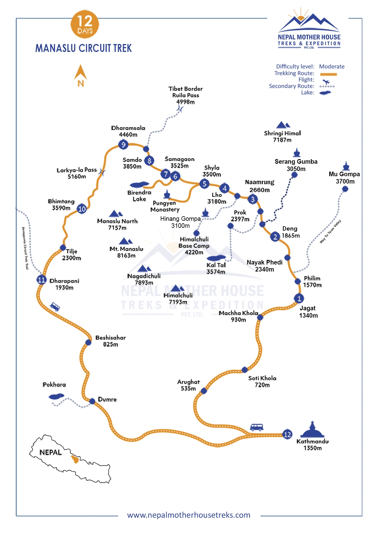
The fuller picture: The route tracks the Budhi Gandaki River north from the lowlands near Gorkha, rises through Gurung, Tibetan, and Nubri communities into alpine villages above 3,500 m, crosses Larkya La, then drops into the Manang side of the Annapurna Conservation Area at Dharapani.
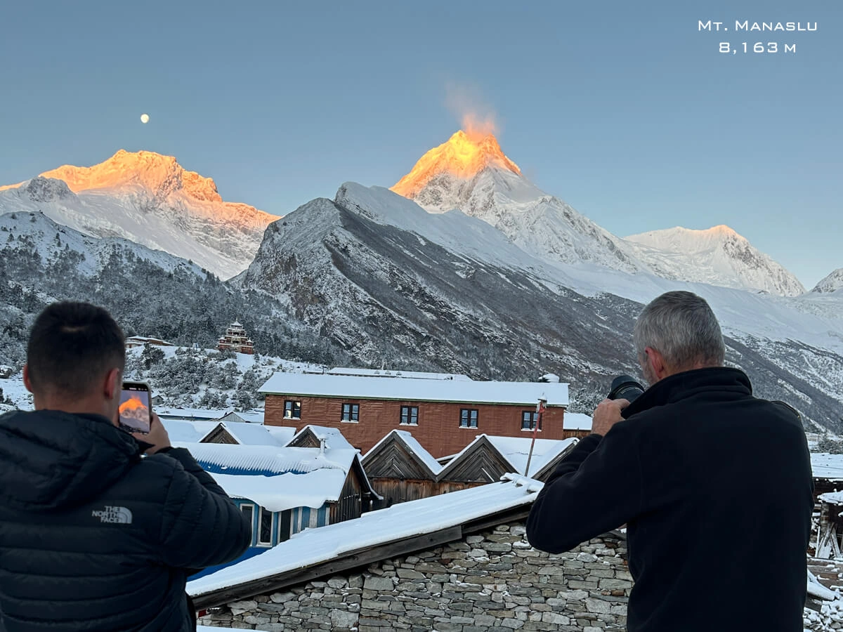
Because Manaslu sits inside a government-restricted area, trekker numbers here are a fraction of what you'd see on Everest or Annapurna. Along the way you'll pass through roughly five distinct ecological bands: subtropical forest and terraced farmland below 1,500 m; temperate forest around Jagat and Deng; the culturally Tibetan villages of Namrung, Lho, and Samagaon between 2,500 and 3,500 m; high alpine terrain around Samdo and Dharmasala; and finally the glacial, wind-raked ground around Larkya La itself. Manaslu—the name translates roughly to "Mountain of the Spirit"—dominates the skyline from Samagaon onward, and a side trip to its base camp is worth the extra day if you have one to spare.
This 12-day version uses road transport as far as Machha Khola (and occasionally Jagat, if road conditions allow) instead of starting the walk from Arughat, as longer, older itineraries originally did. That single change is why the 12-day version works without shortchanging the high-altitude section.
What our guides tell first-timers: The Manaslu Circuit isn't "a smaller Annapurna." The cultural texture — especially around Samagaon and the Tsum-influenced villages — has more in common with a Tibetan pilgrimage route than a commercial trekking corridor. Expect chörtens, mani walls, and monasteries that communities actually use, not sites dressed up for visitors.
A few practical notes:
- Bring a headlamp with spare batteries—several teahouses past Namrung only run electricity in the evening.
- Carry Nepali rupees; there are no ATMs beyond the roadhead.
- Download offline maps (Maps.me or Gaia GPS) before you leave Kathmandu—signal gets patchy from Deng onward.
A mistake worth avoiding: Don't assume the trail matches a blog post from out of date. The road keeps pushing further up the valley almost every year, which shifts both the realistic starting point and the number of days you'll actually need. Please check the current roadhead with your agency before finalizing your flights or itinerary length.
Manaslu Circuit Trek: 12-Day Itinerary
(day-by-day distance, time, and elevation table):
| Day |
Route |
Distance (km) |
Walking/Drive Time |
Elevation (m) |
| 1 |
Kathmandu → Jagat (drive)
|
~150–160 km (road)
|
9–10 hrs (drive)
|
1,340 m
|
| 2 |
Jagat → Deng
|
~20 km
|
6–7 hrs
|
1,860 m
|
| 3 |
Deng → Namrung
|
~19 km
|
5–6 hrs
|
2,630 m
|
| 4 |
Namrung → Lho
|
~13 km
|
4–5 hrs
|
3,180 m
|
| 5 |
Lho-Shyala-Visit Phungen Gumba
|
~13 km total (5 km side trip + 6 km descent)
|
1–2 hrs + 4–5 hrs
|
3,870 m (Gumba), overnight 3,500 m
|
| 6 |
Shyala → Samagaon
|
~6 km total
|
1.5–2 hours
|
3,525 m
|
| 7 |
Acclimatization day in Samagaon (day hike to MBC viewpoint/Visit Nubri Pema Decho Ling Monastery)
|
~7–9 km (round trip)
|
4–6 hrs
|
3,525 m (day hike to ~4,800 m)
|
| 8 |
Samagaon → Samdo
|
~9 km
|
3–4 hrs
|
3,860 m
|
| 9 |
Samdo → Dharmasala/Larke Phedi
|
~7 km
|
3–4 hrs
|
4,460 m
|
| 10 |
Dharmasala → Bimthang (via Larkya La)
|
~24 km
|
8–9 hrs
|
5,106 m (pass), overnight 3,720 m
|
| 11 |
Bimthang → Dharapani
|
~19 km
|
6–7 hrs
|
1,963 m
|
| 12 |
Dharapani → Kathmandu
|
~175 km (road)
|
7–8 hrs (drive)
|
1,350 m
|
Notes on these figures:
- Day 10 (Larkya La crossing) is the hardest day by far — long hours, high altitude, cold pre-dawn starts, and a steep descent afterward. Weather can add significant time here.
- Day 6 is really two half-days stitched together (a side trip plus a short trek down to Samagaon), which is why the hours are broken out separately.
- Day 7's acclimatization hike distance depends on how far the group pushes toward Manaslu Base Camp (4,800 m)—some groups go higher, some turn back earlier.
- Road-based days (1, 12) are approximate driving distances via Arughat/Besisahar; actual road conditions past Arughat can add hours regardless of distance.
- The buffer day (Day 00) exists specifically to absorb weather delays around the pass—a very common reason 12-day itineraries slip to 13.
The itinerary includes a buffer day held free for flight delays, road closures, or an extra rest day in Kathmandu, which is genuinely useful due to the weather-dependent nature of the Larkya La crossing.
Why we build in a buffer day: Landslides and jeep breakdowns on the Arughat–Machha Khola road happen often enough in shoulder-season months that treating Day 12 as guaranteed spare time isn't realistic without it.
A few things worth knowing:
- Confirm with your agency whether Day 1 starts from Soti Khola or Machha Khola — a two-hour difference that shifts the whole schedule.
- Pack a daypack you can reach without opening your full duffel; layers change constantly between Jagat and Namrung.
- On Day 9, your guide sets the actual wake-up time based on that morning's weather — don't book a return flight for the same evening.
The most common self-booking error we see: scheduling an international flight out of Kathmandu on Day 12 with zero buffer. Wind or fresh snow regularly delays Larkya La by half a day, and heavy rain can close the Arughat road for hours. Build at least one spare day into your flight plans.
Want the exact teahouse names and elevation profile? Ask Nepal Mother House Treks & Expedition for a day-by-day PDF itinerary before you book.
Is 12 Days Enough? Difficulty & Fitness Requirements
Short answer: Yes for a fit, experienced trekker. It's tight for a first-time high-altitude trekker, since it leaves only one dedicated acclimatization day before the pass.
The reasoning: This trek is graded strenuous, not extreme—there's no technical climbing—but the mix of sustained daily elevation gain, a single acclimatization stop, and a 5,106 m pass crossing means fitness and pacing matter here more than on Everest Base Camp or the standard Annapurna Circuit.
Difficulty on Manaslu comes from three things: sustained daily walking of 5–7 hours (up to 9 on pass day); a limited number of villages to overnight in, which makes daily distances less adjustable than on busier trails; and genuinely rapid altitude gain between Namrung and Samdo. Trekkers who've already completed one trek above 4,000 m — Everest Base Camp, Annapurna Base Camp, or similar — usually find 12 days comfortable. First-time high-altitude trekkers are generally better served by the standard 14–16 day version or by adding a second acclimatization night at Samagaon.
Our guides carry pulse oximeters and check oxygen saturation twice daily from Namrung onward — not as a gimmick, but because early altitude-illness symptoms are easy to miss when everyone's focused on making the day's distance.
Where we draw the line: we turn down requests to compress this trek to fewer than 11 days of trekking. That's not about upselling a longer package—a rushed ascent profile is the leading cause of turned-back groups at Dharmasala, and turning back that late is far more disruptive than booking an honest schedule from the start.
Getting ready:
- Start a cardio and stair-climbing routine at least 6–8 weeks before departure if hiking isn't already part of your routine.
- Practice walking with a loaded daypack (5–7 kg) over consecutive days, not just once.
- Get medical clearance beforehand if you have any cardiac or respiratory condition — this isn't the trek to test that on.
A mistake worth flagging: Assuming shorter walking distances than the Annapurna Circuit makes this trek easier. Distance isn't the right metric—elevation gain per day and the thinness of the air above 4,500 m matter far more.
Best Time to Trek the Manaslu Circuit
Short answer: Autumn (late September to November) and spring (March to May) are the reliable windows. Winter risks snow closure at Larkya La; the monsoon (June–August) brings landslide risk on the lower trail.
Best Season to Trek Manaslu Circuit
|
Season
|
Months
|
Conditions
|
|
Spring
|
March–May
|
Clear mountain views, rhododendron blooms, stable weather
|
|
Autumn
|
September–November
|
Best visibility, stable trails, peak season crowds
|
|
Winter
|
December–February
|
Larkya La may be snowbound, only for well-prepared groups
|
|
Monsoon
|
June–August
|
Leeches, landslide risk, poor visibility—not recommended
|
Autumn (late Sept–Nov): Clear post-monsoon skies and stable weather windows for the pass crossing, but also the busiest and most expensive permit season.
Spring (Mar–May): Warmer lower valleys, blooming rhododendron through the mid-hills, and slightly lower restricted-area permit fees—though afternoon cloud build-up is more common than in autumn.
Winter (Dec–Feb): Larkya La can shut for days after fresh snow. Only experienced, well-equipped groups should attempt this window, and schedule flexibility becomes essential.
Monsoon (Jun–Aug): The lower Budhi Gandaki valley turns landslide- and leech-prone. Most agencies, including ours, don't recommend this trek during peak monsoon.
A regional detail worth knowing: Late September and early October carry some residual monsoon risk on the lower trail (Machha Khola to Jagat) even when upper-mountain weather has already cleared—we watch the Gorkha district rainfall forecast closely for departures in that window.
Booking tips:
- Book autumn (Oct–Nov) departures 4–6 weeks in advance; rooms above Samagaon are limited.
- Pack a light rain shell even in spring outside of monsoon; afternoon showers below Namrung are common.
- Winter trekkers should build in 1–2 spare days specifically for a possible pass closure.
A mistake to avoid: Booking a fixed international return flight for the day after a winter or early-monsoon departure, with no buffer for a pass closure.
Licensing and Rules (2026 Edition)
Short answer: Four fees apply – the Manaslu Restricted Area Permit (RAP), the Manaslu Conservation Area Permit (MCAP), the Annapurna Conservation Area Permit (ACAP), and a Chumnubri Rural Municipality fee – all arranged through a registered trekking agency.
What changed in 2026: As of March 2026, solo trekkers can obtain the RAP without needing a second "partner" permit. A licensed guide is still mandatory for anyone entering the restricted area. TIMS cards aren't required for the standard route ending at Dharapani.
|
Permit
|
Cost (per person)
|
Notes
|
|
Manaslu RAP — Sept to Nov
|
USD 100 for first 7 days, +USD 15/day after
|
Only issued via a registered agency
|
|
Manaslu RAP — Dec to Aug
|
USD 75 for first 7 days, +USD 10/day after
|
Same rules apply year-round
|
|
Manaslu Conservation Area Permit (MCAP)
|
USD 25-30
|
Flat rate, all seasons
|
|
Annapurna Conservation Area Permit (ACAP)
|
USD 25-30
|
Needed since the route exits through Annapurna Conservation Area near Dharapani
|
|
Chumnubri Rural Municipality fee
|
USD 7-10
|
Paid at Jagat; supports ward-level development
|
|
TIMS card
|
Not required
|
RAP already records trekker details for this route
|
A licensed guide from a registered Nepali agency remains compulsory for the Manaslu Restricted Area. The one real change, effective 22 March 2026, is that the Department of Immigration dropped the long-standing rule requiring a minimum of two trekkers to issue an RAP—a solo traveler with a guide can now get the permit alone, at the standard per-person rate.
How we handle this: We process RAP, MCAP, and ACAP through our Kathmandu office ahead of your arrival wherever possible. The Manaslu RAP specifically needs a copy of passport details, each traveler's travel insurance details that must be valid for the entire trip (maximum 5,106 meters, covering medication and helicopter rescue), and an approved itinerary, so last-minute walk-in applications can delay departure by a day or more—build in at least one full arrival buffer day in Kathmandu before your trek starts.
Is it possible to make permits before we arrive in Kathmandu?
Yes! If you have a time limit or want to avoid staying in Kathmandu, then send us at Nepal Mother House Treks each of your
- passport copies
- Nepal Visa/online Visa submission paper
- passport-size pictures
- insurance details
Then, it is also possible to organize all trekking permits before your arrival.
Good to know before you go:
- Bring two passport photos and a photocopy specifically for the Chumnubri municipality fee at Jagat.
- Permit prices are set in USD but often paid in Nepali rupees at the daily bank rate—carry some cash flexibility.
- A Tsum Valley extension needs its own separate RAP, arranged at the same time as your main permits, not added later.
A mistake to avoid: Assuming a TIMS card from a different Nepal trek (like Everest Base Camp) carries over. It doesn't. Manaslu needs its own restricted-area documentation regardless of any other permit you hold.
Nepal Mother House Treks & Expeditions handles full permit processing—RAP, MCAP, ACAP, and the municipality fee—as part of every Manaslu package. Ask us for the current season's exact permit total when you inquire.
Main Attractions of the Manaslu Circuit Trek – 12-Day Itinerary
The Manaslu Circuit Trek carries you along the wild Budhi Gandaki River, through Tibetan-influenced villages, and up to the icy crown of Larke Pass at 5,106m, all beneath the shadow of Mt. Manaslu, the world's eighth-highest peak. Unlike the crowded trails of Everest or Annapurna, this restricted route in Gorkha District rewards you with living monasteries, yak pastures, and a culture that has changed little in centuries. As a local trekking team from Nepal Mother House Treks & Expedition, we have guided this trail through every season, and we built this guide on what we've seen work and what genuinely surprises our guests, mile by mile.
Quick Overview: What Makes This Trek Special
|
Attraction
|
Best Experienced On
|
Approximate Duration From Nearest Village
|
Terrain
|
|
Pema Choling Gompa (700+ years old)
|
Day 6–7, Samagaun
|
20–30 min walk
|
Stone steps, gentle village trail
|
|
Manaslu Base Camp & Birendra Lake
|
Acclimatization day, Samagaun
|
6–7 hrs round trip
|
Rocky moraine, glacier-fed terrain
|
|
Milarepa's Cave
|
Side trip near Lho/Shyala
|
2–3 hrs round trip
|
Steep, forested, uneven rock steps
|
|
Larke Pass (5,106m)
|
Day 10
|
8–9 hrs Dharamsala to Bhimtang
|
High alpine, glacier, snow and scree
|
|
Lho, Shyala & Samagaun villages
|
Day 5–7
|
4–5 hrs between villages
|
Forest to open alpine valley
|
|
Bhimtang & Phungen Gompa
|
Day 11
|
6–7 hrs from Larke Pass
|
Descent through moraine and pine forest
|
|
Budhi Gandaki river trail
|
Day 2–4
|
6–7 hrs daily
|
River valley, suspension bridges, rocky cliffside
|
Sacred Heritage – Monasteries, Legends & Living Buddhist Culture
Pema Choling Gompa, Samagaun
Tucked above the stone rooftops of Samagaun, this monastery has stood for more than 700 years, and stepping inside feels like walking into a page of Tibetan Buddhist history. Maroon-robed monks still chant here daily, and the walk up from the village center takes only 20 to 30 minutes on a gentle stone path, making it an easy but deeply moving side visit. Trekkers consistently tell us this quiet gompa, not the summit views, is what they remember most vividly.
Birthplace of Yongey Mingyur Rinpoche
Samagaun is also known as the birthplace of Yongey Mingyur Rinpoche, the meditation teacher and author of The Joy of Living. For many trekkers with an interest in Buddhist philosophy, learning the history on the ground, standing where his story began, adds a layer of meaning that no guidebook can replicate.
Milarepa's Cave
A steep, forested side trail near Lho and Shyala leads to the cave where the great Tibetan yogi Milarepa is said to have meditated. The path is short but demands sturdy boots and careful footing on loose rock; budget 2 to 3 hours round trip. It's a raw, humbling stop that grounds the spiritual undertone of this entire trek.
More Than 500-Year-Old Monasteries & Tibetan Border Culture
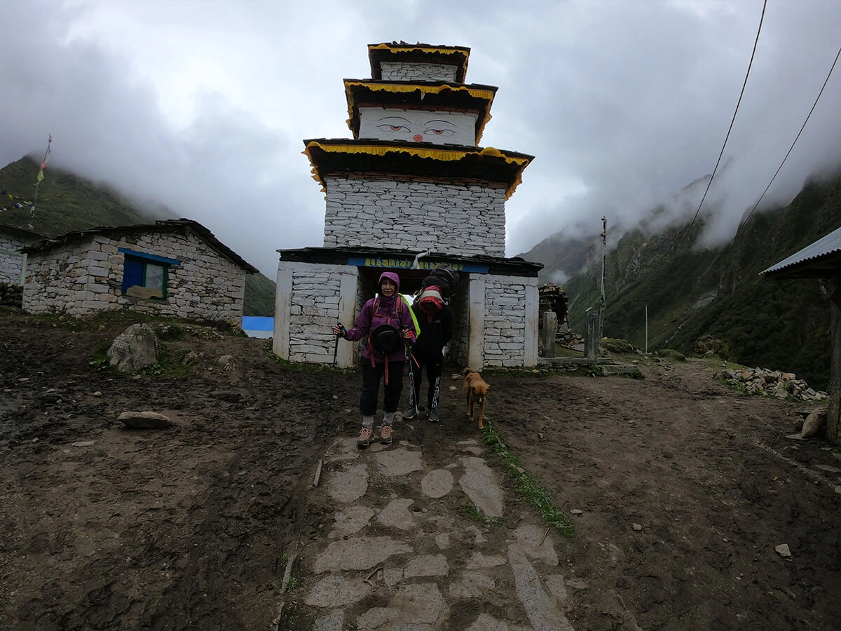
Villages like Lho and Shyala hold monasteries and chortens over 500 years old, and because this valley sits so close to the Tibet border, the architecture, language, and daily life here mirror old Tibetan tradition far more than typical Nepali hill culture. Prayer wheels, mani walls, and fluttering flags line nearly every trail junction, a constant, quiet reminder of how deep this heritage runs.
Natural Wonders – Glaciers, Peaks & High Passes
Mt. Manaslu, Manaslu Base Camp, Birendra Lake & Manaslu Glacier
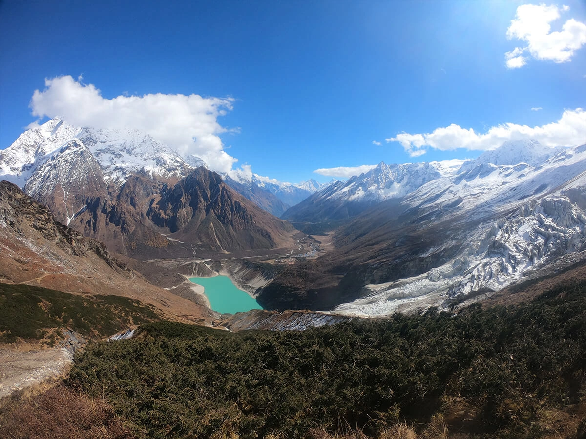
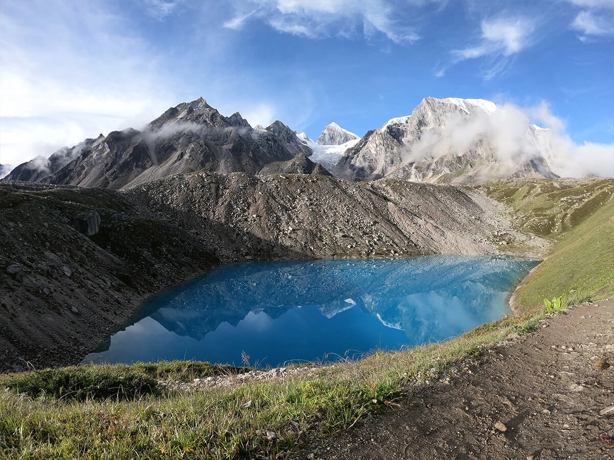
From Samagaun, most trekkers take an acclimatization day to hike up to Manaslu Base Camp, passing the turquoise Birendra Lake fed directly by Manaslu Glacier. Expect a 6- to 7-hour round trip over rocky glacial moraine, with the massive south face of Mt. Manaslu (8,163 m) rising directly ahead. Guests often say this single day, not the pass itself, is the emotional peak of the whole trek.
Larke Pass, 5,106m
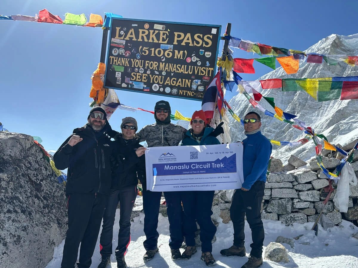
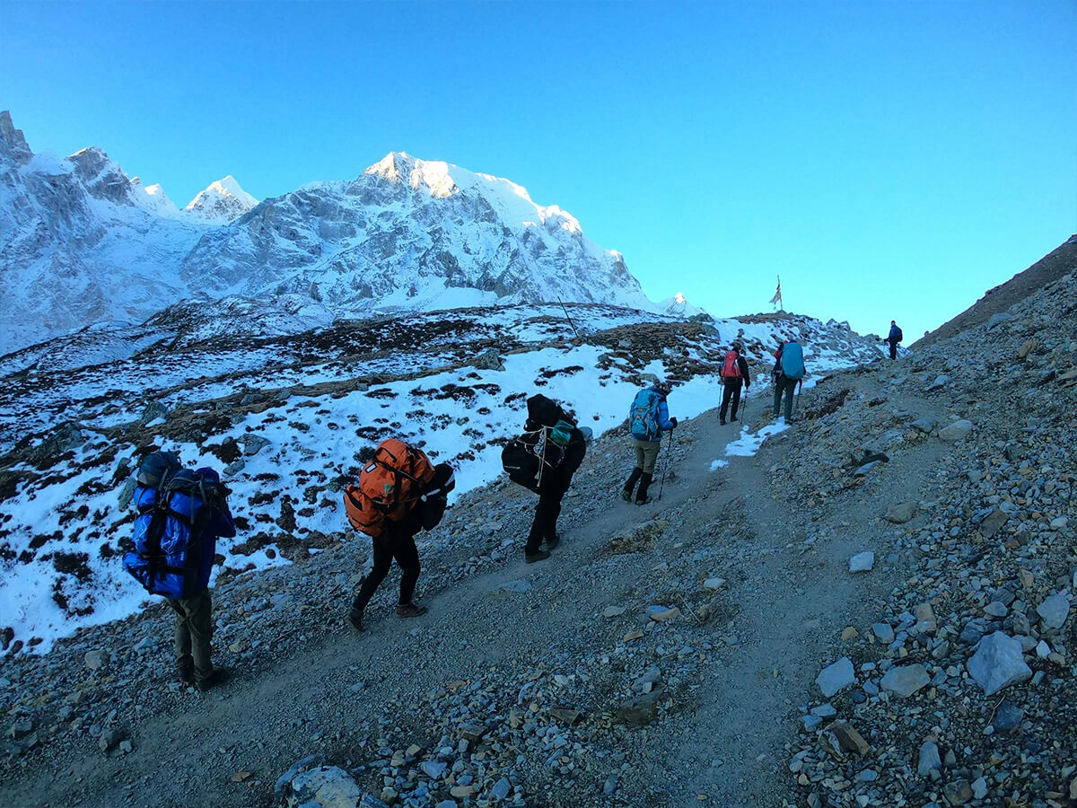
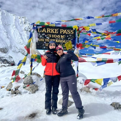
The heart of the journey is crossing Larke Pass on Day 10, an 8- to 9-hour push from Dharamsala (Larke Phedi) to Bhimtang across snow, scree, and glacier-carved terrain. It's physically demanding, and altitude plays a real factor, so an early pre-dawn start and proper acclimatization in the days before matter enormously. Standing at the cairns and prayer flags at the top, with Himlung, Cheo, and Manaslu ranges surrounding you, is the kind of silence that stays with you long after the trip ends.
Phungen Gompa, Shyala, Lho & Samagaun
The string of villages between Lho and Samagaun, backed by Phungen Gompa, sits in a wide alpine amphitheater directly facing Manaslu. The terrain shifts here from pine forest to open valley, and trail time between villages runs 4 to 5 hours on gently rolling paths, gentle enough to enjoy the views rather than just survive them genuinely.
Bhimtang
On the far side of Larke Pass, Bhimtang is a wide, dramatic yak-grazing meadow surrounded by Manaslu, Himlung, and Cheo Himal. After the intensity of the pass crossing, arriving here feels like an exhale, wide skies, total quiet, and some of the clearest mountain panoramas on the entire circuit.
Culture, Lifestyle & Everyday Himalayan Life
- Yak herding and animal husbandry: Above Namrung, yaks become part of daily village life, herded for milk, wool, and transport, a living tradition rather than a tourist display.
- Unique highland lifestyle: Stone houses, Tibetan dialects, and barley fields at 3,000m+ show a way of life shaped entirely by altitude and isolation.
- Geographic diversity, day by day: You'll walk through subtropical river valleys, terraced farmland, pine and rhododendron forests, and finally barren alpine desert, often all within the same week.
- Comfortable teahouse trekking: Despite its remote, restricted-area status, the trail has reliable teahouses offering hot meals, warm blankets, and basic rooms the whole way, no camping required.
The Trail Itself – Budhi Gandaki River & Changing Landscape
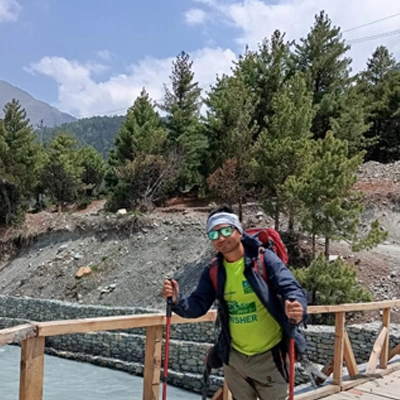
The first four days follow the Budhi Gandaki River through a dramatic river valley, crossing swaying suspension bridges and rocky, cliff-hugging trails carved into the gorge, with roughly 6 to 7 hours of trekking each day. Near Nirshimha Dham, at the junction of the Budhi Gandaki and Akhu Khola, a 1,200-megawatt hydropower project is expected to begin construction soon, which may bring gradual changes to road access in this lower section over the coming years. For now, the valley remains raw, forested, and dramatically undeveloped, a rare feeling on any Himalayan trek in 2026/2027.
Manaslu Circuit Trek Cost Analysis
Quick answer: Depending on season, group size, and transport arrangements, a 12-day Manaslu Circuit Trek with a licensed agency will normally be USD 1,159–1,600 per person for a small group.
What’s fixed and what’s not: The fixed costs you can’t change are permits, a licensed guide, and jeep transport to and from the trailhead. The variables are group size, type of vehicle, and comfort level of the teahouse.
|
Cost item
|
Approx. USD
|
|
Permits (RAP + MCAP + ACAP + municipality fee)
|
175–200
|
|
Guide (12 days, licensed, insured)
|
Included in package
|
|
Porter (optional, per client or shared)
|
12–15/day if added separately
|
|
Teahouse accommodation & meals
|
Included in most packages
|
|
Ground transport (Kathmandu–Machha Khola–Dharapani–Kathmandu)
|
150–300, shared vs. private jeep
|
|
Travel insurance (high-altitude, evacuation cover)
|
Not included—arrange separately
|
|
Personal spending (snacks, showers, charging, wifi)
|
8–15/day
|
Private departures with a dedicated jeep, guide, and porter for one or two people cost more per head than a scheduled small group of 4–8 trekkers, where transport and guide costs are shared.
Worth being cautious about: quotes noticeably below USD 1,000 for a genuine 12-day package with private jeep transport both ways. That price point usually means shared local buses on the rough Arughat road, a shared rather than dedicated guide, or permit costs quietly passed back to you on arrival.
Before you compare quotes:
- Ask exactly what's included in transport—"Kathmandu to Machha Khola" and "Kathmandu to Soti Khola" are different distances at different prices.
- Confirm whether the porter cost is per client or split across the group.
- Buy travel insurance that explicitly covers helicopter evacuation above 5,000 m—generic policies often exclude this altitude.
A mistake to avoid: comparing quotes without verifying if all four permits are included—permit costs alone can vary by USD 100+ per person depending on the season.
Ask Nepal Mother House Treks & Expedition for an itemized quote—we break out permits, transport, guides, and accommodation separately so you can see exactly what you’re paying for.
Accommodation and Food on the Trail
Short answer: Expect family-run teahouses throughout, usually twin-sharing rooms with shared bathrooms, and simple, carbohydrate-heavy food built around dal bhat, noodles, and soup.
The higher you go, the more basic the rooms are. Below Namrung, teahouses are relatively comfortable, some with attached bathrooms and hot showers (gas or solar, sometimes for a small fee). From Samagaon upward, expect basic rooms and shared squat toilets, with no reliable hot shower at Dharmasala—most trekkers skip washing the night before the pass entirely.
Menus revolve around dal bhat (lentils, rice, and vegetables), noodle and pasta dishes, soups, and Tibetan bread—solid, altitude-appropriate fuel, and a second helping of dal bhat is normal. Prices climb with altitude since everything arrives by porter or mule.
Our standard advice: eat dal bhat, not pizza, above Namrung. It isn't about local pride — it's simply the freshest-cooked, most calorie-appropriate option at altitude, while imported items like pizza or chocolate bars have often sat in storage for weeks.
Small things that make a difference:
- Carry a sleeping bag liner even where blankets are provided—bedding isn't always washed between guests at higher elevations.
- Boiled water is sold at every teahouse; bring a SteriPen or purification tablets as backup and to cut down on plastic.
- Wifi is available for a fee as far as Samagaon on a good day and then unreliable to nonexistent.
A mistake worth flagging: expecting the same food variety and comfort at Dharmasala that you had in Kathmandu or even Samagaon. It's genuinely the most basic stop on the trek, by design—very few structures exist there.