| Feature |
Detail |
|
Region
|
Gorkha & Manang districts, Gandaki Province, Nepal
|
|
Duration
|
10–18 days (14–16 days is typical)
|
|
Distance
|
Roughly 150–180 km round trip
|
|
Highest point
|
Larkya La Pass, 5,106 m
|
|
Difficulty
|
Moderate to strenuous
|
|
Where you sleep
|
Teahouses and lodges (basic to mid-range)
|
|
Permits needed
|
Restricted Area Permit (RAP), MCAP, ACAP, Chum Nubri local government permit
|
|
Best months
|
March–May and September–November
|
|
Walking per day
|
5–7 hours on average
|
|
Typical cost
|
US$1,100–$3,500+ per person
|
|
Fitness needed
|
Good to very good
|
|
Guide policy
|
Mandatory—minimum two trekkers with a licensed guide, or one trekker booked through a registered agency
|
|
Restricted area
|
Yes—a special permit and a registered agency are required.
|
Manslu Circuit Trek Trail Update after Heavy Rainfall (24-27 September 2026)
We have received recent updates directly from our guide in Ghap, as well as local stakeholders in Lho Village (Hotel Tashi Delek), Jagat (Jagat Guest House),local transport operators in Kathmandu and Arughat Bazaar, the Kathmandu Immigration Office, and the MCAP Office.
While there were several landslides along the trail due to recent rains (24-27 September 2026), local communities, MCAP, and local police forces are actively working to clear and repair the affected sections and establish alternative paths where necessary.
As a result, the trail for the Manaslu Circuit Trekremains open and walkable. Trekkers are currently traveling from Kathmandu to Machhakhola by jeep and bus, and continuing through Jagat, Deng, Prok, Ghap, Namrung, Lho, Shyala, Samagaun, and Samdo. Efforts are also underway to clear the route across Larkya La Pass. In fact, we are sending another group out on the trek tomorrow.
Additionally, the weather in both Kathmandu and the Manaslu region is currently sunny. By your scheduled departure date, we expect trail conditions to be fully back to normal, so you can safely proceed with your plans as scheduled.
I have attached the itinerary and permit submission as well.
Your safety remains our top priority, and we will keep you closely informed if any further updates arise. Please feel free to reach out if you have any additional questions.
Alternative Route Constructed—Manaslu Circuit Trekking Route Re-Open—9th September
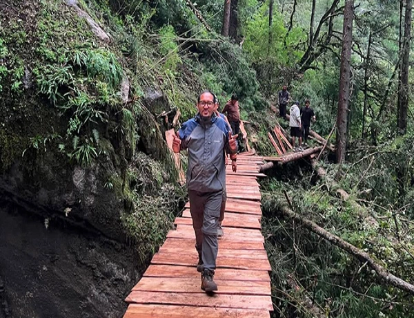
Good news! The Manslu Circuit Trekking Trail has reopened after the new wooden bridge was constructed on an alternative route.
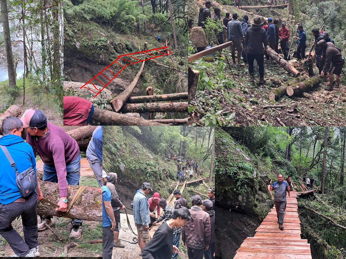 The local government of Chumnubri Rural Municipality, Gorkha, has circulated a notice about the Manaslu Trail condition being hit by a flash flood at Therang Khola at Namrung, Gorkha, on September 06, 2026; a part of the Manaslu Circuit Trekking trail has been disconnected. The Suksam suspension bridge over the Budhi Gandaki River was washed away and had been temporarily disrupted.
According to the Chairperson Pema Gyalpo Lama, Chumnubri Rural Municipality–4, the new temporary wooden bridge has been successfully constructed within four days using wooden logs and local indigenous knowledge. The Manaslu Circuit Trail opened with an alternative trail escape for the affected section. Now, trekkers who are planning to visit the Manaslu Region, Samagaun, and Larke Pass (5,160 meters) can continue the trip using the newly constructed alternative path as scheduled.
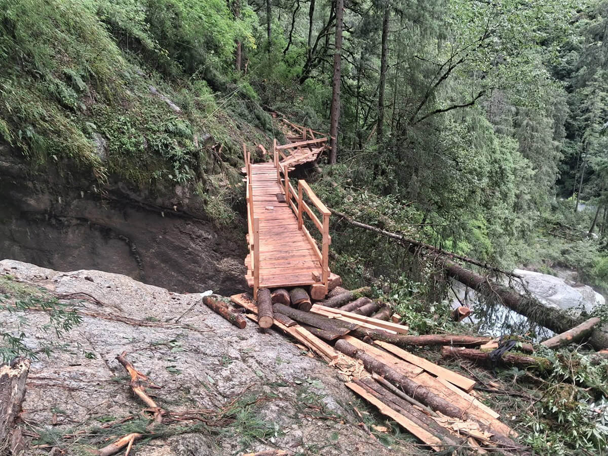
However, trekkers need to be careful while crossing the bridge and taking a selfie.
What is the Manaslu Circuit Trek, exactly?
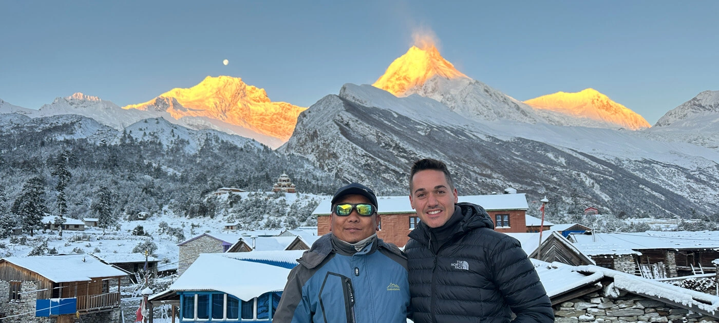
The Manaslu Circuit is a teahouse-based trek that loops around Mount Manaslu (8,163 m) through the Budhi Gandaki Valley, spanning Nepal's Gorkha and Manang districts. The trail climbs from subtropical farmland at the valley floor up to the high, Tibetan-influenced settlements of Sama Gaun and Samdo, tops out at the 5,106 m Larkya La Pass, and then drops down into the Annapurna region near Dharapani.
Why Trekkers Keep Choosing Manaslu
- Genuine solitude. You'll pass dozens of trekkers a day here, not hundreds—an entirely different rhythm from the Everest or Annapurna trails.
- Villages that feel unchanged. Sama Gaun, Samdo, and Lho carry centuries of Tibetan Buddhist heritage—monasteries, chortens, and mani walls that tourism hasn't reshaped.
- A real wilderness pass. Crossing Larkya La has none of the queues you'd find at Everest Base Camp or Kala Patthar.
- Five climate zones in one trek. The scenery shifts almost daily, from lowland rice terraces to high-alpine desert.
- Serious biodiversity. The Manaslu Conservation Area shelters snow leopards, Himalayan tahr, and more than 110 bird species.
- A lighter footprint. Conservation fees on this route go directly toward protecting a valley that still has relatively little tourism infrastructure.
Is It Actually Worth Doing?
For most trekkers, yes. You get Everest-caliber mountain views and Annapurna-level cultural depth, minus the congestion either route now sees. The trade-off is practical rather than scenic: you're required to hire a guide, secure a restricted-area permit, and accept more basic teahouses than you'd find on Nepal's two flagship routes. If solitude and authenticity matter more to you than five-star comfort, Manaslu earns its reputation.
Who Should Consider This Trek?
|
Traveler type
|
How well it fits
|
|
Reasonably fit beginners
|
Good, with proper training and acclimatization
|
|
Experienced trekkers
|
Excellent — physically demanding but not technical
|
|
Couples
|
Good—private departures are easy to arrange
|
|
Solo travelers
|
Well suited, since a guide is required regardless
|
|
Seniors (60+)
|
Workable with extra acclimatization days and a realistic pace
|
|
Photographers
|
Outstanding light, glaciers, and untouched villages
|
|
Families with children
|
Feasible on a slower, private itinerary; children aged nine years old
|
|
Luxury travelers
|
Possible with private staff and upgraded lodges, though options are fewer than on Everest or Annapurna
|
What is the Manaslu Circuit Trek, exactly?
The Manaslu Circuit is a teahouse-based trek that loops around Mount Manaslu (8,163 m) through the Budhi Gandaki Valley, spanning Nepal's Gorkha and Manang districts. The trail climbs from subtropical farmland at the valley floor up to the high, Tibetan-influenced settlements of Sama Gaun and Samdo, tops out at the 5,106 m Larkya La Pass, and then drops down into the Annapurna region near Dharapani.
Why Trekkers Keep Choosing Manaslu
- Genuine solitude: You'll pass dozens of trekkers a day here, not hundreds—an entirely different rhythm from the Everest or Annapurna trails.
- Villages that feel unchanged: Sama Gaun, Samdo, and Lho carry centuries of Tibetan Buddhist heritage—monasteries, chortens, and mani walls that tourism hasn't reshaped.
- A real wilderness pass: Crossing Larkya La has none of the queues you'd find at Everest Base Camp or Kala Patthar.
- Five climate zones in one trek: The scenery shifts almost daily, from lowland rice terraces to high-alpine desert.
- Serious biodiversity: The Manaslu Conservation Area shelters snow leopards, Himalayan tahr, and more than 110 bird species.
- A lighter footprint: Conservation fees on this route go directly toward protecting a valley that still has relatively little tourism infrastructure.
Is It Actually Worth Doing?
For most trekkers, yes. You get Everest-caliber mountain views and Annapurna-level cultural depth, minus the congestion either route now sees. The trade-off is practical rather than scenic: you're required to hire a guide, secure a restricted-area permit, and accept more basic teahouses than you'd find on Nepal's two flagship routes. If solitude and authenticity matter more to you than five-star comfort, Manaslu earns its reputation.
Who Should Consider This Trek?
|
Traveler type
|
How well it fits
|
|
Reasonably fit beginners
|
Good, with proper training and acclimatization
|
|
Experienced trekkers
|
Excellent — physically demanding but not technical
|
|
Couples
|
Good—private departures are easy to arrange
|
|
Solo travelers
|
Well suited, since a guide is required regardless
|
|
Seniors (60+)
|
Workable with extra acclimatization days and a realistic pace
|
|
Photographers
|
Outstanding light, glaciers, and untouched villages
|
|
Families with older children
|
Feasible on a slower, private itinerary
|
|
Luxury travelers
|
Possible with private staff and upgraded lodges, though options are fewer than on Everest or Annapurna.
|
Where the Trek Actually Goes
The route sits in west-central Nepal's Gandaki Province, crossing Gorkha District in the lower and mid-hills and Manang District at the high pass and descent side. It follows the Budhi Gandaki River upstream from Machha Khola, crosses Larkya La, and finishes in the Marsyangdi valley near Dharapani, where it meets the classic Annapurna Circuit trail.
- Starting point: Machha Khola or Jagat, roughly 7–9 hours by road from Kathmandu
- Finishing point: Dharapani or Tilje, with a road connection back to Kathmandu via Besisahar
About Mount Manaslu Itself
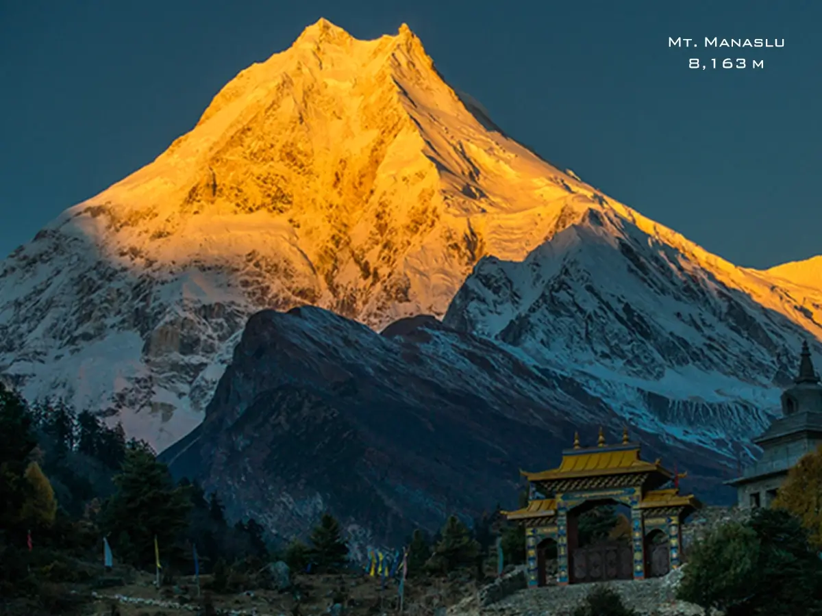
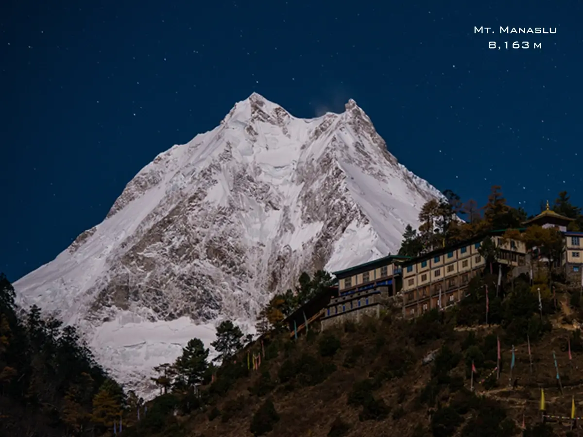
Manaslu (8,163 m) is the world's eighth-highest peak. The name comes from the Sanskrit word "manasa"—"mountain of the spirit" or "intellect"—a fitting label for a summit that dominates the valleys around it. A Japanese expedition made the first ascent on 9 May 1956, with Toshio Imanishi and Gyalzen Norbu reaching the top; the achievement was significant enough in Japan that Manaslu is still sometimes called "Japan's mountain." The peak anchors a massive body of glaciers and satellite summits between 6,000 and 7,000 m that feed the Budhi Gandaki River—a river now also home to a large-scale hydroelectric project—along a valley that has served as a Tibet–Nepal trade corridor for centuries.
A Trek That Opened Late — On Purpose
Manaslu wasn't opened to organized trekking until 1991, decades after Everest and Annapurna, because of its sensitive location near the Tibetan border and its culturally distinct upper villages. It's still classified as a restricted area today, and that status is precisely why the region has retained a character that busier routes have lost.
Buddhist Culture Along the Trail
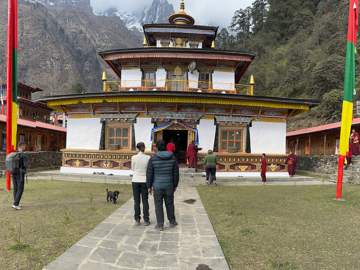
The upper valley — Lho, Shyala, Sama Gaun, and Samdo — is ethnically and culturally Tibetan, home to communities with centuries-old trade and religious links across the border. Expect prayer flags, mani walls, chortens, and monasteries throughout, along with Tibetan Buddhist festival traditions that outside tourism has barely touched. Pungyen Gompa, near Sama Gaun, holds particular weight as a monastery historically tied to Manaslu's sacred status.
Why Is Manaslu a Restricted Region?
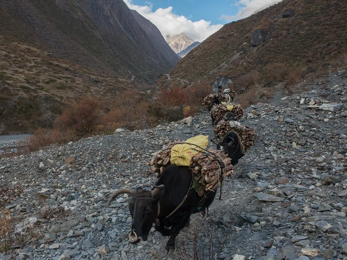
Nepal restricts access to the Manaslu area for border security, cultural preservation, and biodiversity protection. Its proximity to the Tibet Autonomous Region border, combined with a desire to protect the traditional lifestyle of upper-valley communities, means independent trekking isn't allowed here—every trekker must go through a registered Nepali agency with a licensed guide.
The Two Conservation Areas You'll Pass Through
- Manaslu Conservation Area (MCA): Established in 1998, covering about 1,663 km² of the upper Budhi Gandaki Valley and protecting snow leopards, Himalayan tahr, musk deer, and over 110 bird species.
- Annapurna Conservation Area (ACA): Entered near Dharapani on the descent side — part of Nepal's largest and oldest conservation area, established in 1986.
When to Trek the Manaslu Circuit
- Spring (March–May): Rhododendrons bloom in the lower valley, weather is generally stable, and temperatures at altitude are warming. One of the two prime windows.
- Autumn (September–November): The busiest and most reliable season — clear mountain views, settled post-monsoon weather, and comfortable daytime temperatures. It is widely regarded as the best window for crossing Larkya La.
- Winter (December–February): Quiet and cold, with Larkya La at risk of closing. This trek is only suited for well-prepared, flexible trekkers who are carrying serious cold-weather gear and have extra buffer days.
- Monsoon (June–August): Wet and leech-prone in the lower valley, with poor visibility higher up and a greater landslide risk on the Budhi Gandaki gorge sections. Generally best avoided.
|
Month
|
Conditions
|
Recommended?
|
|
Mar–Apr
|
Mild, blooming rhododendron, some haze
|
Yes
|
|
May
|
Warming, pre-monsoon build-up
|
Yes, with caution late in the month
|
|
Jun–Aug
|
Wet, leeches, landslide risk
|
No
|
|
Sep
|
Post-monsoon, the trail is still recovering early on
|
Yes, from mid-to-late September
|
|
Oct–Nov
|
Clearest views, stable weather, busiest
|
Best overall
|
|
Dec
|
Cold, possible early snow at Larkya La
|
Yes, for experienced trekkers
|
|
Jan–Feb
|
Very cold; pass may close
|
Only with flexible dates
|
How Difficult Is the Manaslu Circuit?
Rated moderate to strenuous. There's no technical climbing involved—no ropes, no scrambling—but the trek demands sustained daily walking of 5 to 7 hours, several long ascent days, and one genuinely demanding high-altitude crossing at Larkya La that plays out like a summit day: a pre-dawn start, cold temperatures, and 8–9 hours on your feet.
Altitude Gain and Pacing
The trail climbs from around 870 m at Machha Khola to 5,106 m at Larkya La over roughly 10–11 trekking days, then drops to about 1,860 m at Dharapani. Well-built itineraries keep the net daily elevation gain above 3,000 m to somewhere around 400–500 m, with two acclimatization days worked in—typically at Lho/Shyala and again at Sama Gaun.
How to Acclimatize Properly
- Rest days built in at Sama Gaun (3,530 m), with a side hike to Manaslu Base Camp or Pungyen Gompa, and often another at Samdo (3,875 m)
- "Climb high, sleep low" day hikes above your overnight altitude wherever the schedule allows
- 3–4 liters of water daily once above 3,000 m, with a deliberately conservative pace
- Knowing the early warning signs of AMS and having a clear turn-back plan (more on this below)
Getting Fit for the Trek
Aim to comfortably manage 5–6 hours of hiking on hilly terrain with a daypack on back-to-back days. A simple eight-week build-up:
- Weeks 1–2: Cardio 3–4 times a week — hiking, brisk walking, or cycling — for 30–45 minutes
- Weeks 3–4: Add hill repeats or stair climbing while carrying a 6–8 kg daypack
- Weeks 5–6: Long back-to-back weekend hikes (4–6 hours), plus leg and core strength work twice a week
- Weeks 7–8: Taper the volume, keep the intensity, and prioritize sleep and injury prevention
A Realistic Prep Timeline
- 3+ months out: Book with a registered agency (required for the RAP), lock in dates, start training
- 6–8 weeks out: Sort travel insurance with high-altitude and helicopter evacuation cover, plus visas
- 2–4 weeks out: Finalize gear, break in your boots, get any recommended vaccinations
- 1 week out: Your agency processes permits (RAP, MCAP, ACAP)—this can't be done far in advance since it needs your passport and finalized group details
Trekking With Kids, as a Senior, Solo, or as a Woman
- Children: Workable for those older than seven years in our experience or older teenagers on a slower, private itinerary with extra acclimatization days—not advisable for young children given the altitude and remoteness.
- Seniors: Very achievable with realistic daily distances, an added acclimatization day, and travel insurance that explicitly covers your age bracket and altitude.
- Solo travelers: A guide is legally required, so solo trekkers receive automatic support—ask your agency about joining a small group to share porter and permit costs.
- Women traveling alone: Generally considered safe, especially with a reputable local agency; ask about a female guide if you'd prefer one.
What "Luxury" Looks Like on Manaslu
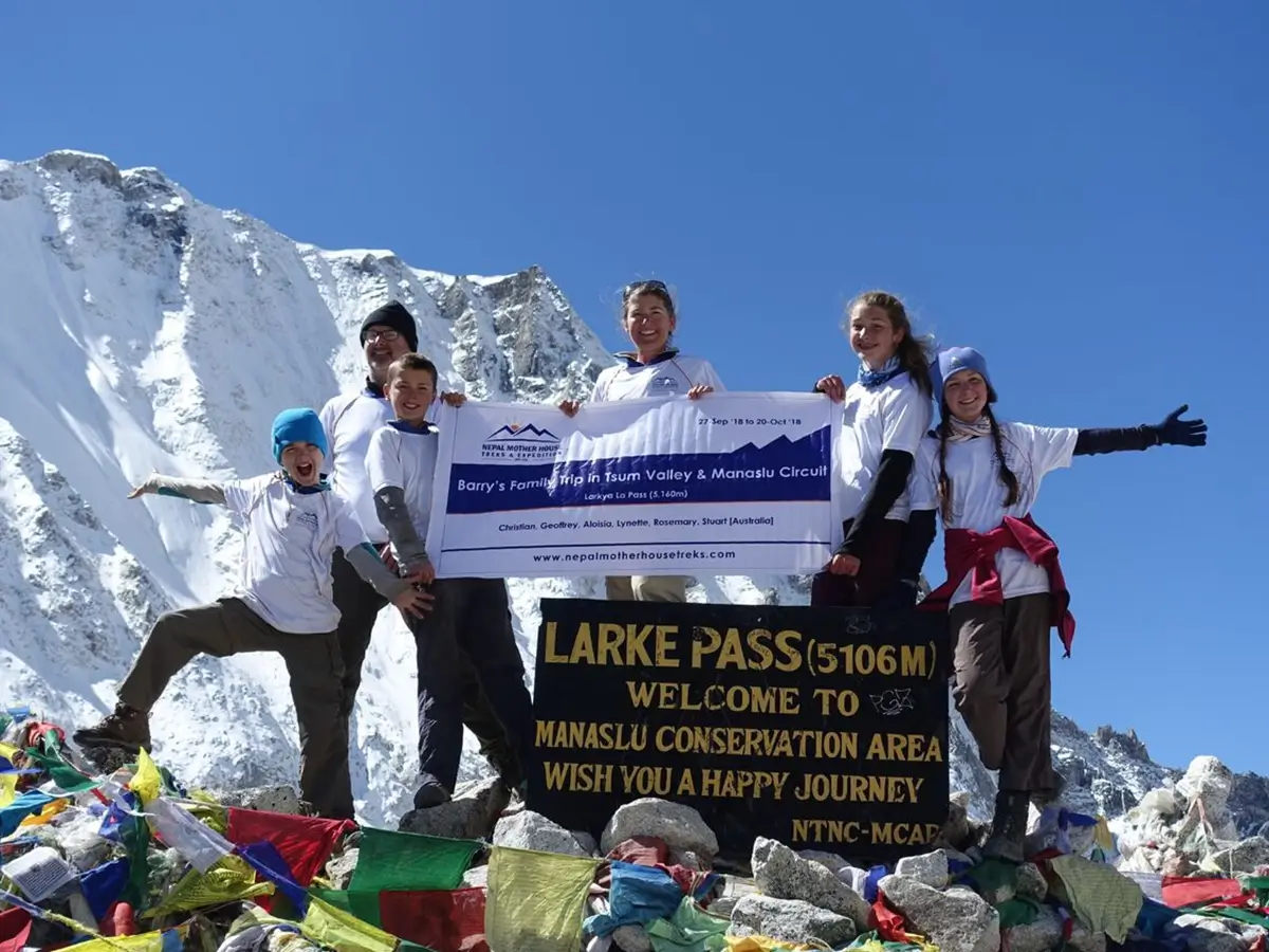
Private guides, private porters, and upgraded lodge rooms with attached bathrooms (available in places like Machha Khola, Jagat, Deng, Namrung, Lho, Sama Gaun, Samdo, and Bhimtang) can all be arranged, along with heli-assisted starts or finishes on some itineraries. Manaslu simply has fewer high-end lodges than Everest or Annapurna, so "luxury" here means privacy, pace, and service rather than boutique hotels—worth knowing before you set expectations.
Manaslu Circuit Trek Route Overview
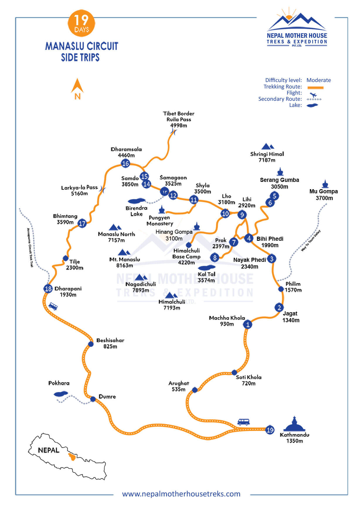
The classic line runs: Machha Khola → Jagat → Deng → Namrung → Lho → Shyala → Sama Gaun → Samdo → Dharamsala → Larkya La (5,106 m) → Bimthang → Tilje → Dharapani, usually over 14–16 days once you include acclimatization and buffer days.
Sample Itinerary Options
- Option 1—Shortest Manaslu Circuit (9 Days): A fast-paced version for trekkers short on time, driving as far as possible before starting the walk and crossing Larkya La by day seven.
- Option 2 — Manaslu Circuit with Serang Gumba (12 Days): Adds a visit to the remote, historic Serang Gumba monastery before rejoining the classic route toward Lho and Sama Gaun.
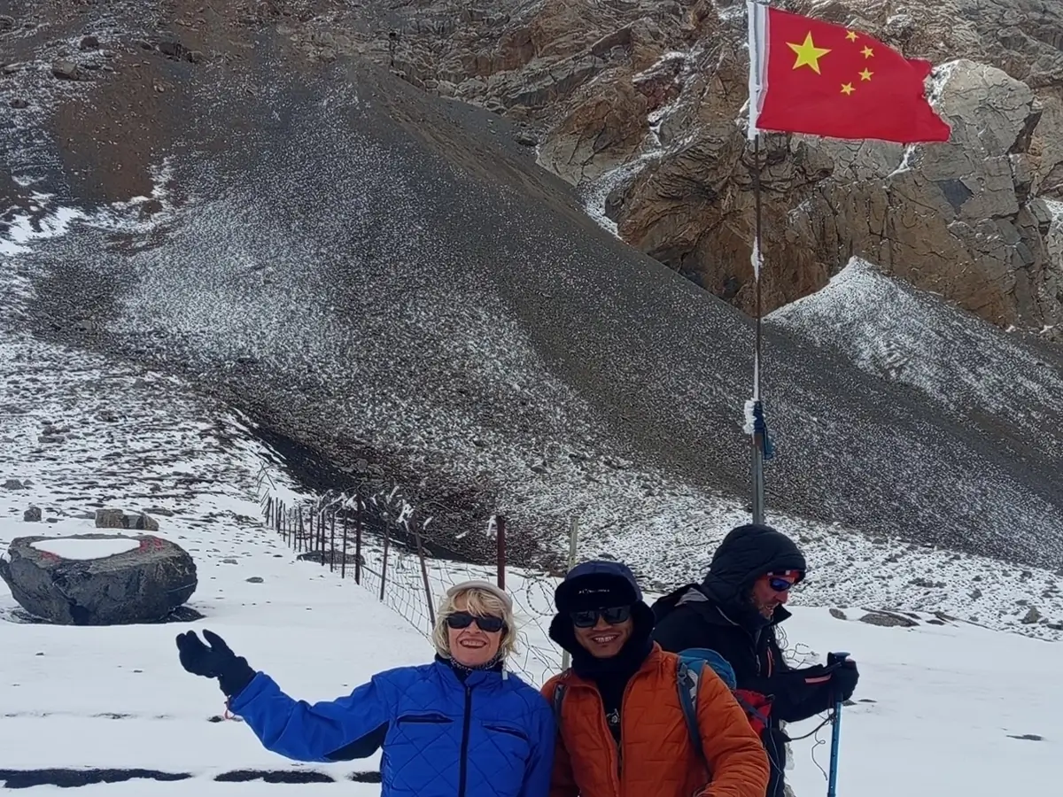
- Option 3—Manaslu Circuit with Rui La Pass, Tibet Border (14 Days): Includes a side excursion to Rui La Pass on the Nepal–Tibet border (subject to local security conditions and Chinese border authority permission), plus a detour through Prok Village and Kal Tal Lake.
- Option 4 — Manaslu Circuit with Extended Side Trips (18 Days): A slower-paced version that weaves in Serang Gumba, Kal Tal, Hinang Gompa, and Himalchuli Base Camp before the main climb to Sama Gaun and the pass.
- Option 5—Manaslu & Tsum Valley (18 Days): Combines the sacred Tsum Valley—including Mu Gompa and Milarepa's Piren Phu cave—with the full Manaslu Circuit and an optional visit to the Tibet border.
- Option 6 — Ultimate Manaslu & Tsum Valley Trek (30 Days): The deepest exploration on offer, tying together Tsum Valley, Gumba Lungdang, Ganesh Himal Base Camp, Serang Gumba, and Hinang Gompa alongside the full circuit.
- Option 7 — Manaslu Circuit with Nar Phu Valley (30 Days): Extends the standard circuit into the remote Nar Phu Valley, crossing the demanding Kang La Pass (5,320 m) before finishing near Chame.
All of the above are flexible: on the ground, you can discuss changes with your guide day to day (aside from restricted-area entry dates, which are fixed by permit). Full day-by-day breakdowns, current permit costs, and departure dates for each of these itineraries are available on request from our team—this lets us tailor the pacing to your fitness, season, and available days rather than locking you into a fixed template.
Villages You'll Pass Through
- Machha Khola: The trailhead village on the Budhi Gandaki, with basic teahouses and the last easy road access.
- Jagat: A stone-paved gorge village and the first permit checkpoint.
- Deng: Marks the entry into the Manaslu Conservation Area's core zone.
- Namrung: The point where Tibetan-influenced architecture and language start to show.
- Lho: Home to a hilltop monastery and the trek's first classic Manaslu viewpoint.
- Shyala: A small, high-alpine settlement close beneath Manaslu's north face.
- Sama Gaun (Samagaon): The trek's hub — the largest village in the upper valley and the base for Manaslu Base Camp and Pungyen Gompa side trips.
- Samdo: A historic trans-border trading village and the last stop before the pass approach.
- Dharamsala (Larkya Phedi): A staging-lodge cluster with no permanent settlement, used purely for pass-day logistics.
- Larkya La: The trek's high point, marked by chortens and prayer flags, with views toward Himlung Himal and Cheo Himal.
- Bimthang: A high meadow on the descent with some of the trip's best mountain panoramas.
- Tilje and Dharapani: Marsyangdi Valley villages where the route joins the classic Annapurna Circuit.
Worthwhile Side Trips
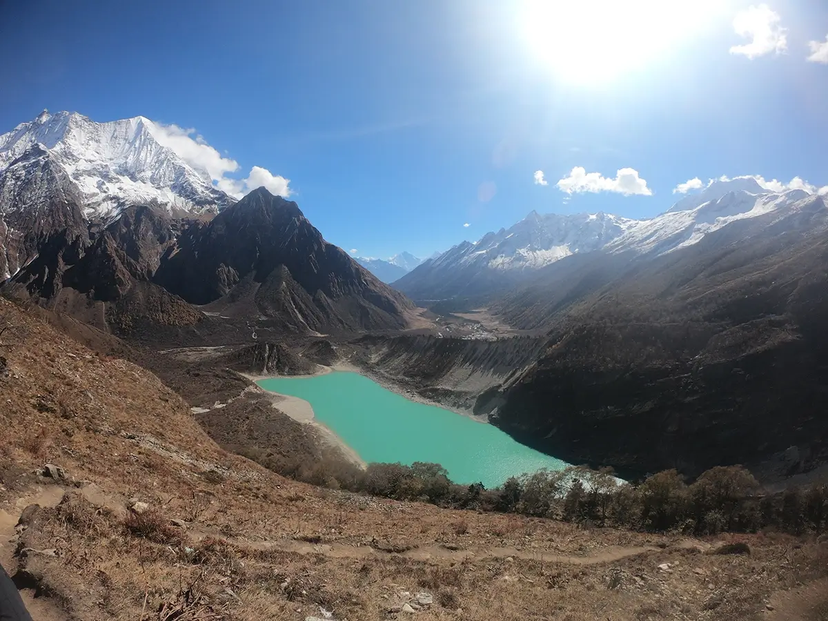
- Birendra Lake: An accessible glacial lake walk near Sama Gaun—a good half-day acclimatization outing.
- Pungyen Gompa: A culturally important monastery hike from Sama Gaun.
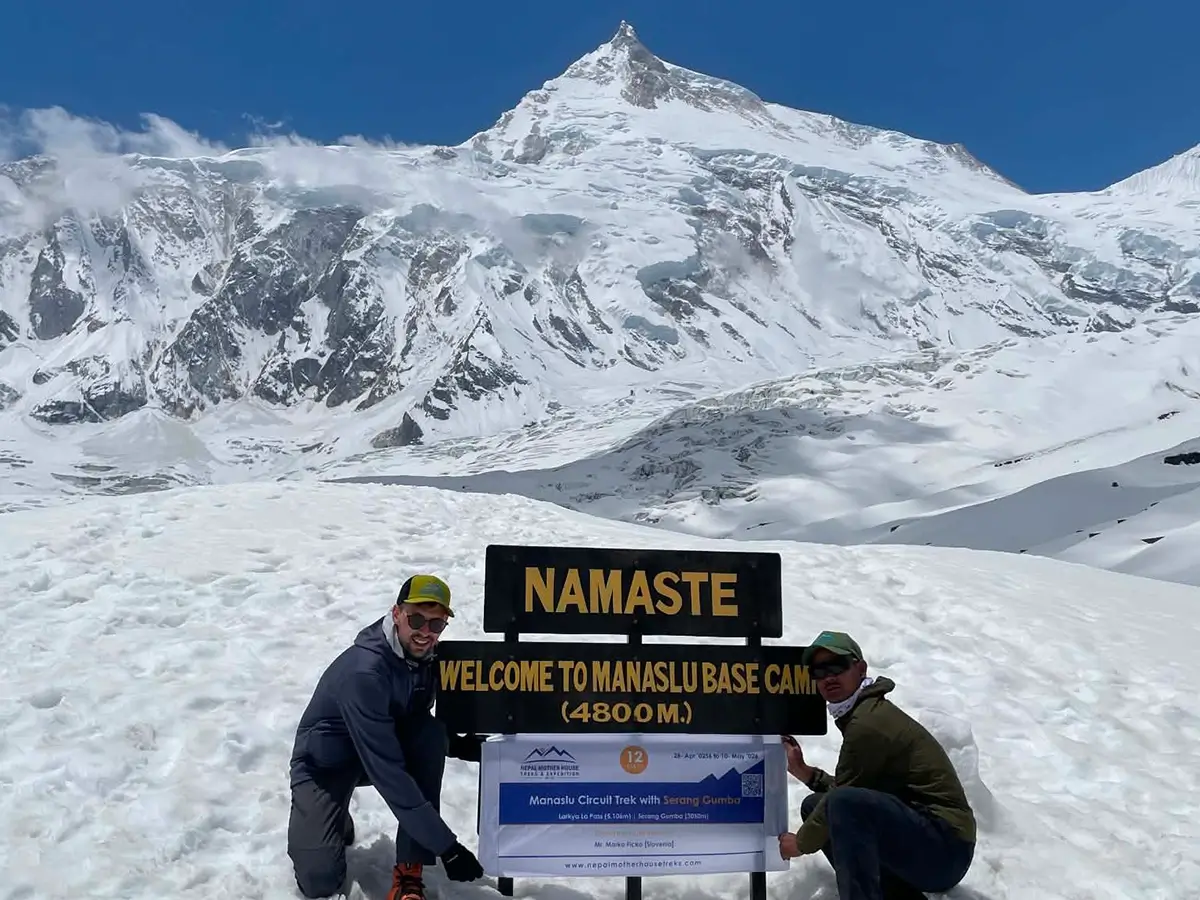
- Manaslu Base Camp: A full-day, higher-altitude outing (around 4,800 m) for trekkers acclimatizing well.
- Tsum Valley: A popular multi-day extension for trekkers with extra time, rather than a simple side trip.
- Serang Gumba: A remote, centuries-old Tibetan Buddhist monastery in Gorkha's Nubri Valley.
- Kal Tal (Kamochan Tal): A pristine high-altitude glacial lake near Prok village.
- Hinang Gumba: A sacred Buddhist monastery in the Nubri Valley at Manaslu, known for its peaceful setting and Himalayan scenery.
- Milarepa's Cave: A meditation cave associated with the Tibetan yogi Milarepa, an important pilgrimage stop near Manaslu Base Camp.
- Rui La Pass (4,998 m): A striking pass on the Nepal–Tibet border at Border Pillar No. 35, offering cross-border views (access depends on local security conditions).
Permits You'll Need
|
Permit
|
Purpose
|
Notes
|
|
Restricted Area Permit (RAP)
|
Required for the entire Manaslu region
|
Priced per week, higher in peak season; only issued through a registered agency
|
|
Manaslu Conservation Area Project (MCAP) fee
|
Funds conservation work in the MCA
|
A single fee covering your whole trek
|
|
Annapurna Conservation Area (ACAP) fee
|
Covers the descent side near Dharapani |
Standard ACA entry fee
|
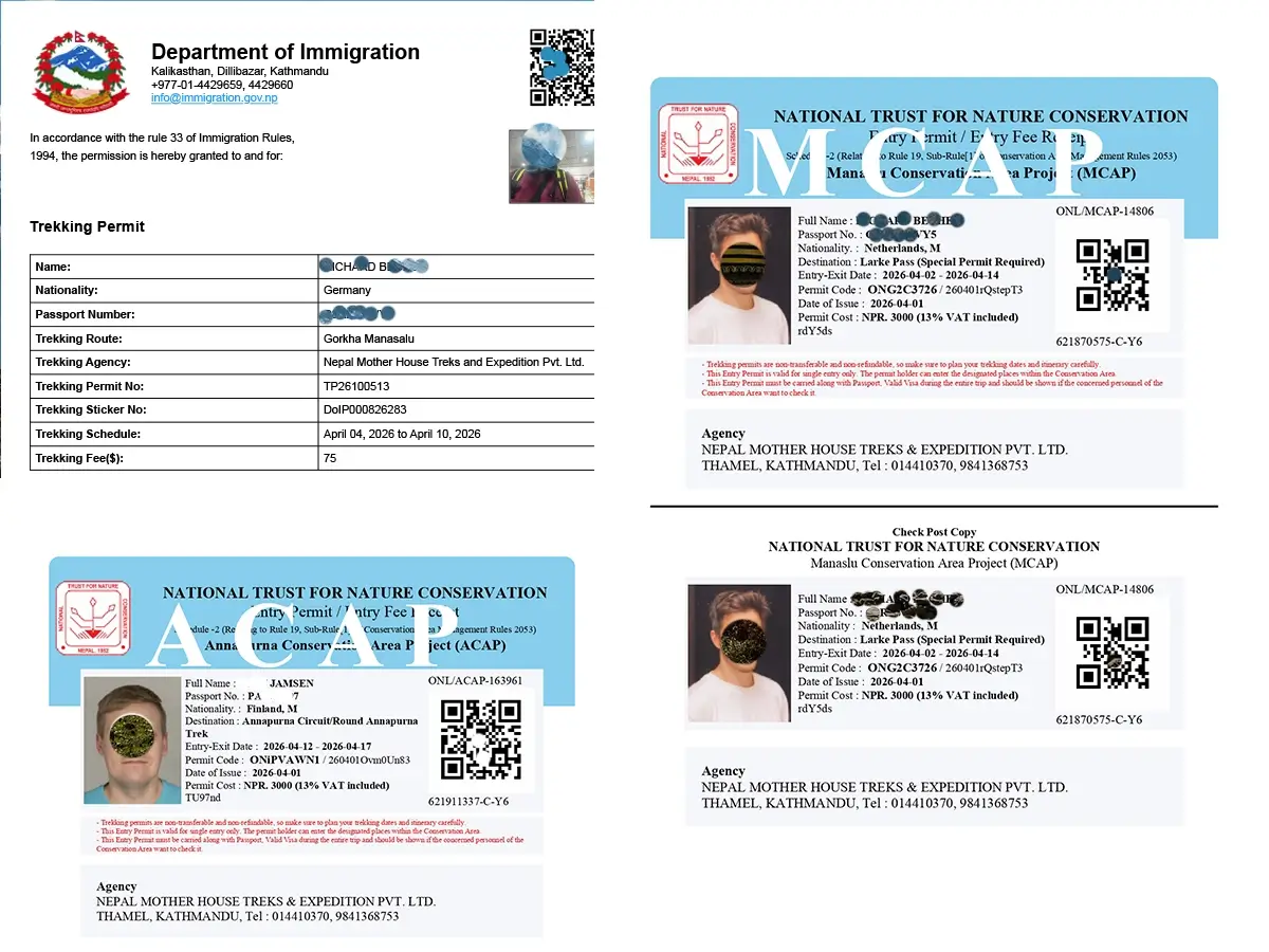
Permit fees shift periodically, so always confirm current pricing with your agency before booking — this guide itself is reviewed only twice a year.
What It Costs
|
Category
|
Budget teahouse
|
Mid-range
|
Private/Luxury
|
|
Permits
|
Included in most packages
|
Included
|
Included
|
|
Guide
|
Shared/group guide
|
Dedicated guide
|
Private guide
|
|
Porter
|
Shared
|
One porter per two trekkers
|
Private porter
|
|
Accommodation
|
Basic teahouse
|
Better teahouse rooms
|
Best available, occasional upgrades
|
|
Food
|
Set teahouse menus
|
Same, more variety
|
Some Kathmandu-restaurant-quality meals
|
|
Transport
|
Local jeep/bus
|
Private jeep
|
Private jeep both ways
|
|
Insurance
|
Arranged separately
|
Arranged separately
|
Arranged separately
|
|
Equipment rental
|
Extra
|
Extra
|
Often included
|
|
Approx. total per person
|
US$1,100–$1,600
|
US$1,700–$2,400
|
US$2,500–$3,500+
|
Sample 15-Day Budget Breakdown
|
Item
|
Approx. cost (USD)
|
|
Permits (RAP + MCAP + ACAP + local government)
|
$215–$260 (season-dependent)
|
|
Shared guide
|
$175–$225
|
|
Shared porter
|
$150–$175
|
|
Teahouse accommodation and food
|
$450–$550
|
|
Kathmandu–Machha Khola–Dharapani–Kathmandu transport
|
$120–$220
|
|
Estimated total (excluding insurance & gear)
|
$1,110–$1,430
|
Getting There and Getting Around
- Kathmandu → Machha Khola: 7–9 hours by local bus or private jeep via Arughat; a private jeep is faster and far more comfortable over the rough final stretch.
- Dharapani → Kathmandu: 7–8 hours by jeep via Besisahar; some trekkers break the return trip overnight in Besisahar or Pokhara.
Life on the Trail
- Accommodation: Teahouses the whole way—basic twin rooms with shared bathrooms common above Namrung and better facilities lower down.
- Food: Dal bhat, noodle soups, momos, porridge, and simple Tibetan-style dishes; menus thin out and prices rise the higher you climb.
- Water: Boiled, filtered, and bottled water are all available at lodges—bring a filter, purification tablets, or a SteriPEN to cut down on plastic and cost.
- Internet: Paid Wi-Fi is intermittent in the lower villages and largely unavailable above Namrung, so plan for offline days at altitude.
- Electricity: Solar charging is available at most teahouses for a fee; bring a power bank as backup.
- Mobile network: NTC has broader coverage than Ncell along this route, though the signal becomes patchy above Sama Gaun.
- ATMs: None on the trail. The last reliable ATM is in Kathmandu, occasionally Arughat—carry enough Nepali rupees for the entire trek.
- Money tip: Budget extra cash for hot showers, Wi-Fi, charging, and bakery items—these are cash-only and add up fast.
Packing List
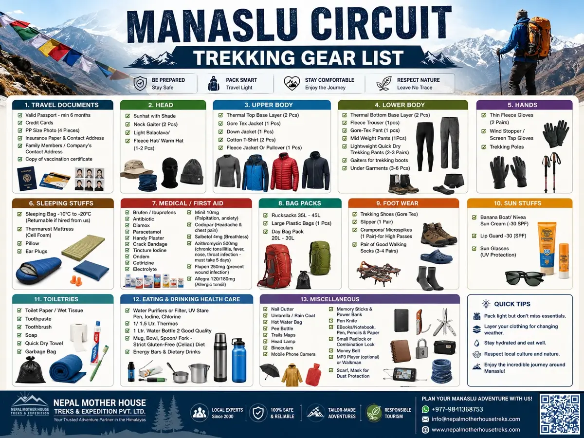
Clothing: Moisture-wicking base layers, a fleece or down mid-layer, a waterproof/windproof shell, an insulated down jacket for high camp and pass day, trekking trousers, thermal underwear, warm and sun hats, lightweight and insulated gloves, and a buff or neck gaiter.
Footwear: Broken-in waterproof trekking boots, camp shoes, 3–4 pairs of trekking socks plus liners, and gaiters for snow on pass day.
Electronics: Headlamp with spare batteries, power bank, universal adapter, camera or phone, and an optional solar charger.
Documents: Your passport photocopies and passport-size photos for permits; travel insurance details, which must cover up to 5,106 meters; permit paperwork (handled by the trekking agency); and cash in Nepali rupees.
Medicines: Personal prescriptions; altitude sickness medication (discuss with your doctor first); a broad-spectrum antibiotic and rehydration salts as agency-guided; blister care; a basic first-aid kit; and water purification tablets.
Safety: Altitude, Insurance, and Guides
Recognizing and Handling Altitude Sickness
Headache, nausea, dizziness, appetite loss, and disturbed sleep are the common early warning signs of acute mountain sickness. Confusion, a severe headache that doesn't respond to medication, loss of coordination, or breathlessness at rest are warning signs of the more serious HAPE or HACE and require immediate descent.
- Prevention means ascending gradually, respecting the built-in acclimatization days at Sama Gaun and Samdo, staying well hydrated, skipping alcohol at altitude, and discussing preventive medication with a travel medicine doctor beforehand.
- Treatment: mild symptoms must halt further ascent and may ease with rest and drinking fluids. Worsening symptoms require immediate descent—non-negotiable, regardless of itinerary or money already spent on the trip.
- Emergency response: A reputable trekking company previously provided satellite communication, but now mobile networks and Wi-Fi service are available along almost the entire trek. We coordinate helicopter evacuation with insurance providers when needed; confirm this capability with the agency you book through.
Travel Insurance
Choose a policy that explicitly covers high-altitude trekking to at least 5,106 m and includes helicopter evacuation. Many standard travel policies exclude trekking above 3,000–4,000 m unless you add that coverage specifically.
Guides and Porters
A licensed guide from a registered Nepali agency is a legal requirement for the Manaslu region, enforced through the Restricted Area Permit process itself. A porter is optional but strongly recommended, both for your own comfort and to support local livelihoods—the standard is one porter per two trekkers.
Traveling Responsibly
Support teahouses and porters directly, cut down on single-use plastic with a filter bottle, respect monasteries and religious sites (ask before photographing ceremonies or interiors), and book with an agency that pays fair, transparent wages.
Wildlife and Photography
The Manaslu Conservation Area is home to snow leopards, Himalayan tahr, and musk deer, though sightings of the rarer species are uncommon—birdlife is much easier to spot. For photography, early morning light (before 8 am) on Manaslu from Lho and Bimthang is consistently the most dramatic. Carry spare batteries, since cold drains them fast at altitude.
Cultural Etiquette on the Trail
Walk clockwise around mani walls, chortens, and stupas; ask before photographing people or monastery interiors; dress modestly in villages; and remove your shoes when entering homes or gompas if asked to.
Mistakes Worth Avoiding
- Skipping or shortening acclimatization days to save time
- Treating Larkya La as "just another pass day"
- Under-packing warm layers for Dharamsala and pass day
- Booking with an unregistered operator that can't legally secure the Restricted Area Permit
- Not carrying enough cash for the stretch with no ATMs
- Ignoring early AMS symptoms instead of reporting them to your guide right away
How Manaslu Compares
1. Manaslu Circuit vs. Everest Base Camp
|
Factor
|
Manaslu Circuit
|
Everest Base Camp
|
|
Crowds
|
Low
|
High
|
|
Max altitude
|
5,106 m (pass)
|
5,364 m (base camp)
|
|
Guide required
|
Yes, legally
|
Recommended, not mandatory
|
|
Flights involved
|
No, road access
|
Yes — Lukla flight, often delayed
|
|
Cultural depth
|
High, Tibetan-influenced
|
High, Sherpa culture, more commercialized
|
|
Infrastructure
|
Basic teahouses
|
More developed lodges
|
|
Overall feel
|
Remote, quiet, authentic
|
Iconic, social, busier
|
2. Manaslu Circuit vs. Annapurna Circuit
|
Factor
|
Manaslu Circuit
|
Annapurna Circuit (classic)
|
|
Crowds
|
Low
|
Moderate to high
|
|
Guide required
|
Yes, legally
|
No, optional
|
|
Road encroachment
|
Minimal
|
Significant on parts of the route
|
|
Permit complexity
|
Higher (restricted area)
|
Lower (ACAP + TIMS)
|
|
Village character
|
More traditional
|
Increasingly modernized in places
|
Neither route is objectively ""better"—Manaslu trades convenience for solitude and a legally mandated pass crossing, while Everest and Annapurna offer more developed infrastructure and, in Everest's case, iconic status.
Frequently Asked Questions
How long is the Manaslu Circuit Trek?
Most itineraries run 14–16 days, including acclimatization and buffer days, covering roughly 150–180 km round trip.
How difficult is the Manaslu Circuit Trek?
Moderate to strenuous. No technical climbing skills are needed, but it involves sustained daily walking and one demanding high-altitude crossing at 5,106 m.
Do I need a guide for the Manaslu Circuit Trek?
Yes. A licensed guide from a registered Nepali agency is legally required because Manaslu is a restricted trekking area.
Can I trek Manaslu Circuit without a permit?
No. You need a Restricted Area Permit, MCAP entry, and ACAP entry, all processed through a registered trekking agency.
How much does the Manaslu Circuit Trek cost?
Budget teahouse packages typically run US$1,100–$1,600 per person; mid-range packages, US$1,700–$2,400; and private or luxury itineraries, US$2,500–$3,500 and up.
What is the best time to trek the Manaslu Circuit?
Autumn (September, October, and November) and spring (March, April, and May) have the most stable weather and the clearest mountain scenery.
How high is Larkya La Pass?
5,106 meters (16,752 feet), the trek's highest point.
Is the Manaslu Circuit Trek good for beginners?
Yes, for first-time trekkers with perfect physical fitness and proper preparation, it's more demanding than a beginner's easiest options but manageable.
Is altitude sickness a serious risk on the Manaslu trek?
Normally, No! The trek climbs to 5,106 m, so acclimatization days and awareness of AMS symptoms are essential.
What is the accommodation like on the Manaslu Circuit?
Basic to mid-range teahouses are found throughout, with simpler facilities as you climb higher.
Is there Wi-Fi on the Manaslu Circuit Trek?
Intermittent, paid Wi-Fi is available in the lower villages; above Namrung, it is unreliable to nonexistent.
Are there ATMs along the trail?
No. Carry enough Nepali rupees in cash before leaving Kathmandu.
What permits do I need for the Manaslu Circuit?
Restricted Area Permit (RAP), Manaslu Conservation Area Project (MCAP) entry, and Annapurna Conservation Area (ACAP) entry.
Can solo travelers do the Manaslu Circuit Trek?
Yes — since a guide is mandatory anyway, solo trekkers are automatically supported, and joining a small group can reduce per-person costs.
Is the Manaslu Circuit Trek safe for women traveling alone?
Generally yes, especially with a reputable local agency; female guide options can be requested.
What is the food like on the trek?
Mostly in the teahouse, they offer such items as dal bhat, noodle soups, fried potatoes, fried rice, bread, momos, and porridge, with menus becoming basic in high-area places.
How do I get to the start of the Manaslu Circuit trekking?
Traveling by road from Kathmandu to Machha Khola or Jagat takes roughly 8–10 hours by local bus or private jeep.
Is travel insurance required?
Not legally required but strongly recommended, with coverage explicitly for high-altitude trekking and helicopter evacuation.
Can I combine the Manaslu Circuit with Tsum Valley?
Yes, Tsum Valley is a popular multi-day extension combined with the lower Manaslu trail for trekkers with extra time.
What is the maximum elevation gain per day?
Well-designed itineraries limit net gain to roughly 400–500 m per day above 3,000 m, with two acclimatization days built in.
Is the Manaslu Circuit Trek better than Everest Base Camp?
Neither is objectively better—Manaslu offers more solitude and a legally mandated pass crossing, while EBC offers iconic status and more developed infrastructure.
Do I need snow or ice gear for Larkya La?
Basic gaiters and trekking poles are usually enough in normal conditions; microspikes may be advised after fresh snowfall, based on your guide's real-time assessment.
What should I pack for the coldest part of the trek?
An insulated down jacket, insulated gloves, a warm hat, and thermal base layers for Dharamsala and the Larkya La crossing.
Is monsoon season possible for this trek?
Not recommended — the lower valley is prone to leeches and landslides, and visibility at altitude is poor.
How many acclimatization days should I include?
At least two days are needed—one at Sama Gaun and one at Samdo—with a third buffer day being a wise addition for older or less experienced trekkers.
Can children trek the Manaslu Circuit?
It's feasible for fit, older teenagers on a slower private itinerary but not recommended for young children given the altitude and remoteness.
Is the Manaslu Circuit Trek crowded?
No — thanks to its restricted-area status, it remains one of Nepal's quietest major treks.
What wildlife might I see?
Birdlife is common; snow leopard, Himalayan tahr, and musk deer live in the Manaslu Conservation Area, though sightings of the larger mammals are uncommon.
What does the name "Manaslu" mean?
The name Manaslu comes from the Sanskrit words "manasa," which means "mountain of the spirit," reflecting the mountain's cultural and spiritual significance in the region.
Who was the first to summit Manaslu?
Toshio Imanishi and Gyalzen Norbu, members of a Japanese expedition, reached the summit on 9 May 1956.
How do I book the Manaslu Circuit Trek?
Through a registered Nepali trekking agency—only registered agencies can process the mandatory Restricted Area Permit on your behalf.
Final Thoughts
The Manaslu Circuit rewards trekkers looking for what Everest and Annapurna offered decades ago: real remoteness, unhurried village life, and a high-altitude pass crossing you'll remember for its wildness rather than its crowds. It asks a bit more of you logistically—a mandatory guide, restricted-area permits, and simpler teahouses—but for most people who accept that trade-off, it's the trek they talk about longest. If you're weighing fitness, timing, or budget against your travel dates, our team can help you build the right itinerary before you commit.
Why choose Nepal Mother House Treks & Expedition Pvt. Ltd. for your trekking adventure?
- Local information from staff in Nepal with real, hands-on experience in the Manaslu region, not a remote distributor.
- Competent, professional guides with the appropriate qualifications for hiking in limited regions and up-to-date knowledge of the trails
- A safety-first approach with co-ordinated emergency evacuation support and altitude management techniques
- Treks in small groups or entirely on your own that meet your schedule, fitness level and pace
- Fair wages for the porters and guides, environmentally friendly procedures and a genuine commitment to the local communities along the trail
- Transparent pricing, no hidden fees for travel, permits or housing upgrades
- Specialized support for individuals, couples, families, organizations and individuals from Australia, the United Kingdom, the United States, Canada and other regions of Europe and Asia-Pacific
Ready to plan your Manaslu Circuit Trek?
Contact Nepal Mother House Treks & Expedition Pvt. Ltd. to get a personalized itinerary and pricing based on your dates, fitness level, and budget.
Ready to plan your Manaslu Circuit Trek? Contact Nepal Mother House Treks & Expedition Pvt. Ltd. for a customized itinerary and quotation built around your dates, fitness level, and budget.