Where is Mount Everest located?
Mount Everest is located in the Khumbu region of east Nepal. It sits on the international border between Nepal and the Tibet Autonomous Region of China. On the Nepal side, Everest, the world’s tallest mountain, is protected in Sagarmatha National Park, a UNESCO World Heritage Site, in the Mahalangur Himal section of the Himalayan Mountain Range. Many travelers seek clear travel information about where Mount Everest is found, its location on a map, or which country it is in before planning an Everest Base Camp trek or a Himalayan adventure.
The summit is located at approximately 27.9881° N, 86.9250° E, about 160 kilometers (100 miles) northeast of Kathmandu. In the local language, it has two much older names: Sagarmatha in Nepal and Chomolungma in Tibet.
If you've ever run your finger across a map searching for the world's highest point or questioned whether an 'average' person could even get close to it, this guide is designed to answer that clearly and without the typical fluff. We will cover the coordinates, the border between Nepal and China, the two base camps, the villages and peaks around the mountain, and the actual ways that travelers (not just professional climbers) travel.
Our Nepal-based trekking team reviews this guide each season after returning from the Khumbu region themselves so the permit prices, trail conditions, and timing advice below reflect what’s actually happening on the ground rather than recycled facts from a decade ago.
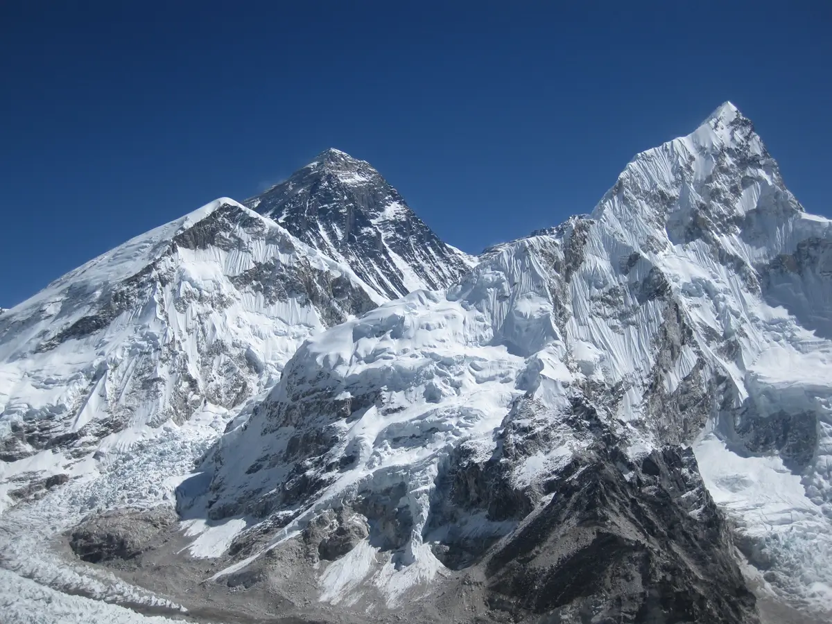
Key facts:
- Coordinates: 27° 59′ 17″ N, 86° 55′ 30″ E
- Altitude: 8,849m (29,032ft) above sea level
- Border: South: Nepal North: China/Tibet
- Closest major city: Kathmandu, about 160 km (100 miles) southwest of the summit
- Gateway airport: Tenzing-Hillary Airport, Lukla, Nepal
- Administrative region: Koshi Province, Khumbu, Solukhumbu District (Nepal); Shigatse Prefecture, Tingri County (Tibet)
- Local names: Chomolungma (Tibetan), Sagarmatha (Nepali)
Zoom out on a world map, and Everest is in South Asia, a sort of natural hinge between the Indo-Gangetic plains to the south and the high, dry Tibetan Plateau to the north.
Is Everest in China or in Nepal?
The truth is, it is both, but not completely.
The side of Nepal
Most of the popular climbing routes and the more frequented of the two base camps are located in Nepal's Sagarmatha National Park in the Khumbu region. Sagarmatha roughly translates to “Forehead of the Sky.”
The Tibetan side
The north face of the mountain is in the Tibet Autonomous Region of China and accessed through Tingri County. Before the English name was used, Tibetans called the mountain Chomolungma, or “Goddess Mother of the World.”
Where the true border is
The summit itself is almost on the border between the two countries. In practical terms, a climber standing on the summit has one foot in Nepal and the other in Tibet, China.
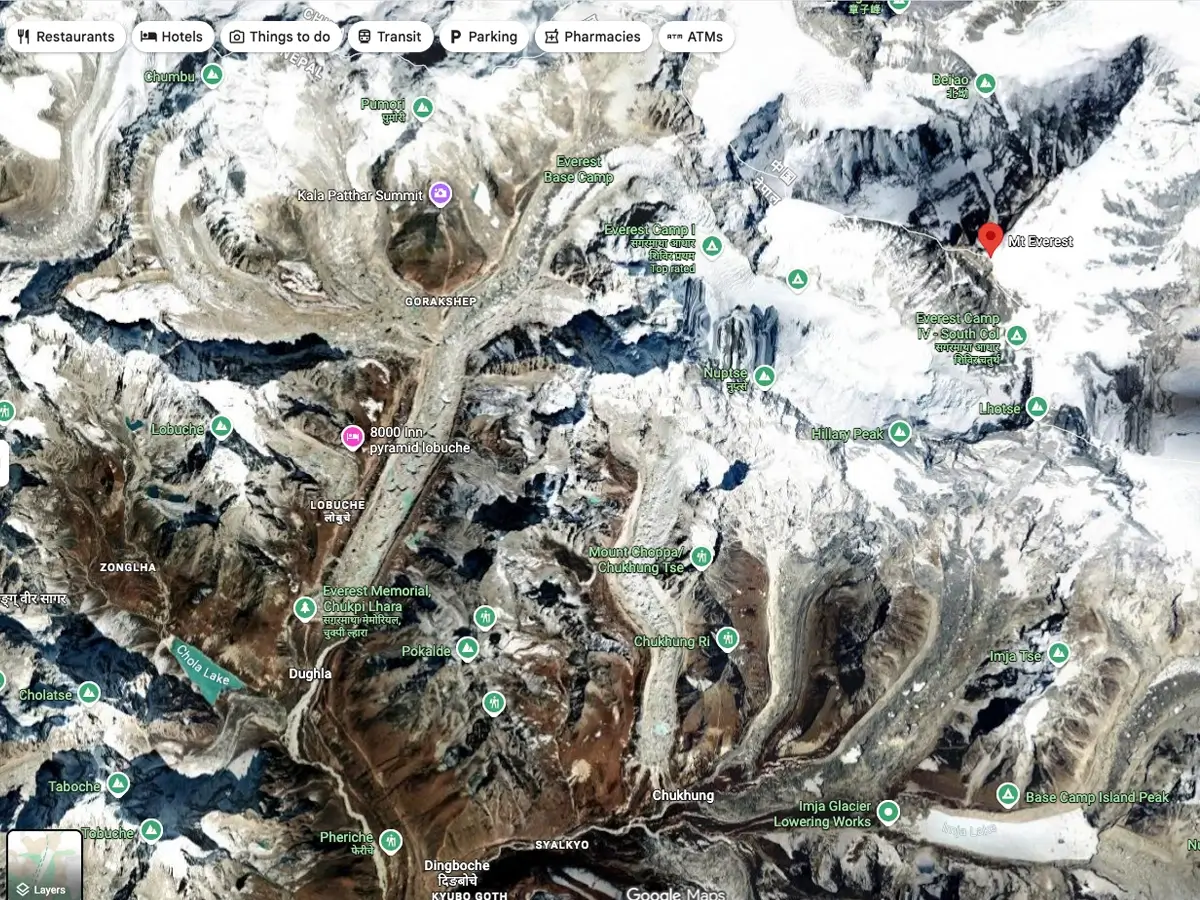
How can one mountain belong to two countries?
The geology of Everest doesn't mention a border; it's a single mass of rock rising along the crest of the Himalayan range. The political boundary is along the natural watershed ridge, the same rationale used for much of the Nepal-China boundary through this stretch of mountains.
The experience of visiting is what makes the difference between the two sides. Nepal implements this approach through Sagarmatha National Park and district offices. China controls its side through the Tibet Autonomous Region, which means a different visa, a separate travel permit, and a whole different style of trip.
What Mountain Range Does Everest Belong To?
Everest is part of the Mahalangur Himal, a sub-range of the Greater Himalayas, the tallest mountain range on Earth, stretching approximately 1,500 miles through Nepal, India, Bhutan, China, and Pakistan.
This section of the Himalayas is crowded for giants: it has four of the world’s fourteen peaks above 8,000 meters, Everest, Lhotse, Makalu, and Cho Oyu, all within a relatively small radius of one another.
How it all came about: The Himalayas are created because the Indian tectonic plate has been crashing into the Eurasian plate for about 50 million years, and that crash is still ongoing. The plates keep shifting, and Everest is still creeping upward a few millimeters a year. Satellite measurements show it ’ s also drifting slightly northeast.
How to Spot Everest on a Regional Map
Pull back a bit more, and the dense cluster of extreme-altitude peaks along the Nepal-China frontier makes Everest visible.
What is on the map around it:
- Nepal – just south and southwest of
- China Tibet Autonomous Region – directly to the north
- India—further south, bordering both Nepal and the wider Himalayan arc
- Bhutan - east, along the same mountain chain
- Kathmandu—roughly 160 km southwest, the main entry point for most travelers
- Lhasa - the primary gateway city for the northern route
If you draw a line from Kathmandu northeast, you’ll go through Lukla, Namche Bazaar, and the Khumbu Valley before you finally reach Everest—this is the route that the vast majority of trekkers and expeditions take.
Where Are the Base Camps on Everest?
There are two, not one, base camps, on opposite sides of the mountain, and they are polar opposites.
South Base Camp, Nepal
Elevation: 5364 m (17,598 ft)
- Located on: Khumbu Glacier, Sagarmatha National Park
- Getting there: only by foot, over several days from Lukla—no roads lead to it
- Traffic: by far the busier of the two, where most trekkers and climbing teams stay
North Base Camp – Tibet
- Altitude: 5,150 m (16,900 ft)
- Sits on: Tingri County, Tibet Autonomous Region
- How to get there: car for most of the way and then a short walk
- Traffic: Generally quieter, with stricter permit regulations and a shorter travel season
Side-by-Side Comparison
|
Feature
|
South Base Camp (Nepal) |
North Base Camp (Tibet) |
|
Elevation
|
5,364 m
|
5,150 m
|
|
How to reach it
|
Trekking only
|
Mostly by vehicle
|
|
Paperwork needed
|
National park permit + TIMS card
|
Chinese visa + Tibet travel permit
|
|
Typical trip length
|
12–14 days
|
8–10 days
|
| How busy it gets |
Very busy |
Comparatively quiet
|
Do You Have to Be a Climber to See Everest?
No, and this fact surprises a lot of people. Most of the visitors to the Everest region are trekkers with no technical climbing background at all, not mountaineers.
The Nepal route (which is what most people do)
- Arrive at Tribhuvan International Airport, Kathmandu
- Short connecting flight to Lukla or a full-day drive to Surke.
- Trek Namche Bazaar, Tengboche, Dingboche and Lobuche.
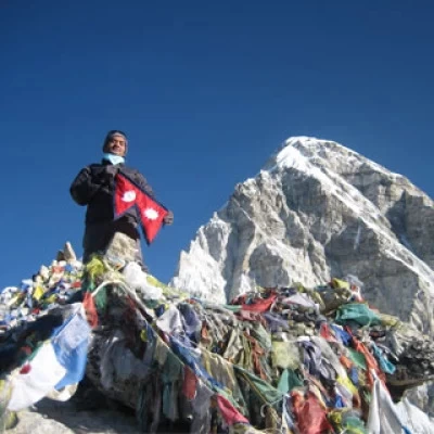
- Arrive at Everest Base Camp and often continue to Kala Patthar for the classic summit view
The Tibet route
- Fly to Lhasa, or travel overland from Kathmandu
- Prearrange a Chinese visa and Tibet travel permit.
- Drive to Rongbuk Monastery, then to North Base Camp.
Helicopter rides:
If you don’t have a week or two to spend at altitude, helicopter tours from Kathmandu or Lukla can get you up to Base Camp or Kala Patthar in a day, often stopping for a brief photo stop and then returning.
A scenic flight:
Fixed-wing sightseeing flights out of Kathmandu skim along the Himalayan skyline for close views of Everest, with no trekking or overnight stay required—a good option if your schedule is really tight.
Road Drive from Kathmandu:
The jeep drive from the capital city, Kathmandu, to Surke (1-2 hours walking distance below Lukla), takes almost 16 to 18 hours via Salleri and Phaplu.
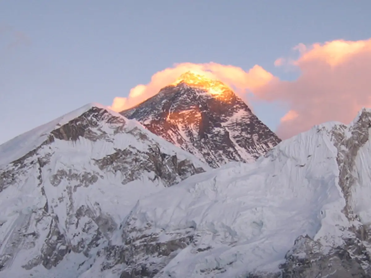
Why the Majority of Visitors Are Drawn to Nepal
The southern route is much more popular than the Tibetan side, and for good reason:
- Infrastructure: Decades of tourism have developed a near-continuous string of teahouses, lodges, and guide services along the trail.
- Sherpa hospitality: The Khumbu region is the home of the Sherpa people, and much of the trekking experience revolves around their villages and monasteries and their skills as high-altitude guides.
- The scenery itself: the walk traverses some of the most beautiful mountain scenery anywhere, with Lhotse, Nuptse, and Ama Dablam visible for much of the trek.
- Less paperwork: Nepal’s permit system—a Sagarmatha National Park entry permit and a local municipality fee—is much less bureaucratic than getting a Chinese visa and Tibet travel permit.
Sagarmatha National Park: A Closer Look
Sagarmatha National Park encompasses the entire Nepal-side approach to Everest and is located in Solukhumbu District in the Koshi Province.
- Established 1976
- UNESCO designation: World Heritage Site, 1979
- Area: approximately 1148 sq km
- Wildlife: includes snow leopards, Himalayan tahr, red pandas, and over 200 recorded bird species.
- Terrain: high alpine forest at about 2,800 m to the summit of Everest at 8,849 m
- This park is a must-see for every trekker heading to South Base Camp, and the entry fee helps keep it protected.
The Villages on the Trail
The Nepal trek links a string of Sherpa settlements, each built around a resupply or acclimatization point.
- Lukla – the starting point, with the only airstrip in the region
- Phakding – the first overnight stop, by the Dudh Kosi River
- Namche Bazaar – the biggest town in the area, and the main stop-off point for trekkers to acclimatise
- Tengboche – home to the area's most important Buddhist monastery, with Everest behind it Dingboche – a higher altitude stop to help acclimatise before the final stretch
- Lobuche—a small settlement near to the Khumbu Glacier
- Gorak Shep – the last village before Base Camp and Kala Patthar
The Peaks Around Everest
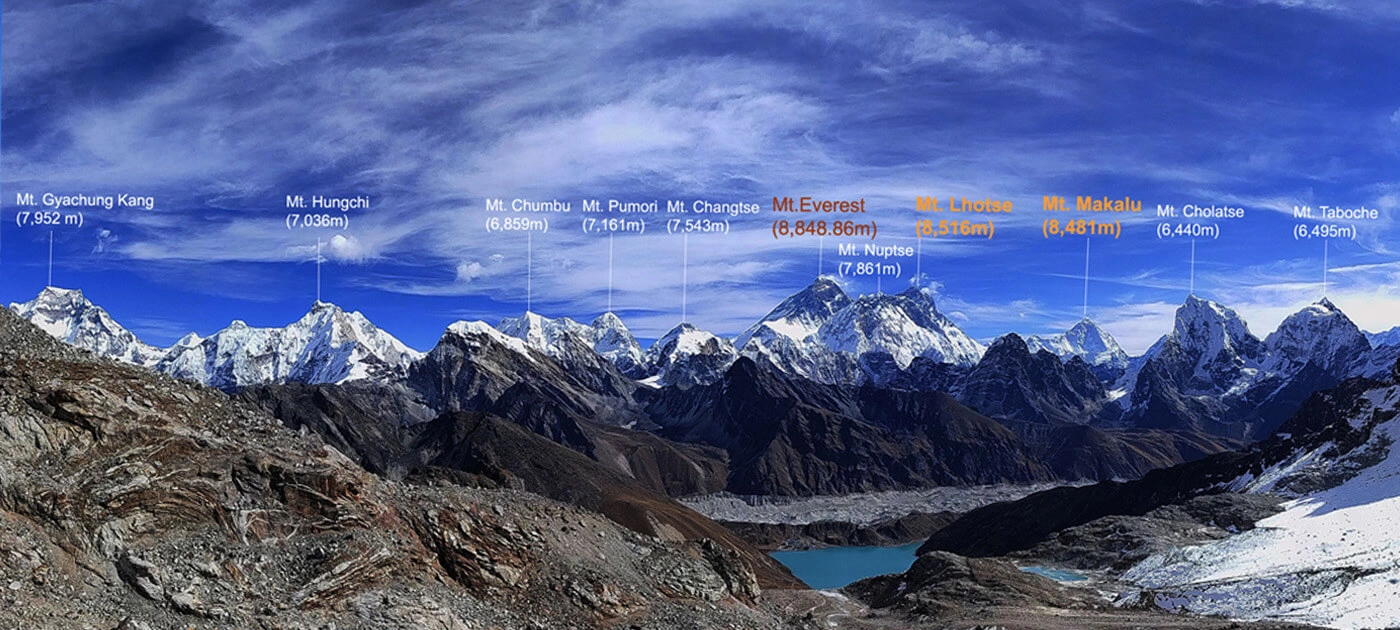
Everest is not alone; it is one of a cluster of giants visible for most of the trek.
- Lhotse (8,516 m)—Everest's neighbor, the fourth highest peak in the world
- Nuptse (7,861 m) – Forms the dramatic wall above Base Camp
- Makalu (8,485 m) – The fifth highest peak in the world, with views from Kala Patthar
- Cho Oyu (8,188 m) – The sixth highest, west of the Khumbu Valley
- Ama Dablam (6,812 m)—less tall than the giants that surround it, but widely considered to be the most beautiful peak in the Himalayas
- Pumori (7,161 m)—the peak that looms directly above Base Camp
Some Facts to Know About the Location of Everest
- The summit itself is situated almost exactly on the Nepal-China border, meaning the very top is technically in both countries.
- The mountain is still rising, a few millimeters a year, as the Indian and Eurasian plates continue to crash into each other.
- The English name, honoring British surveyor Sir George Everest, came after its two local names, Sagarmatha and Chomolungma.
- In 1953, Sir Edmund Hillary and Tenzing Norgay Sherpa made the first confirmed ascent, starting from the Nepalese side.
- Everest is the furthest point above sea level, but it is not the tallest mountain from base to peak, nor is it the closest point to the center of the Earth—those honors go to different mountains.
When Should You Really Go?
- Spring (March – May): the most active and most dependable time, with clear weather and the best climbing conditions higher on the mountain.
- Autumn (September-November): Nearly as popular as spring, with fresh, clear air and much smaller crowds.
- Winter (December - February): cold and much quieter, suited for travelers with experience of harsh conditions.
- Monsoon (June-August): wet, cloudy, and generally not recommended for trekking—though it is the emptiest time of year if solitude matters more than visibility.
How To Get There, Step By Step.
- Fly into Kathmandu, Nepal's principal international air portal.
- Take a short domestic flight to Lukla, landing on one of the most talked-about mountain airstrips anywhere.
- Travel through the Khumbu Valley, normally 8-9 days to Base Camp, stopping over at Namche Bazaar, Tengboche and Dingboche on the way.
- Or for a day trip, skip the days on foot with a helicopter tour from Kathmandu or Lukla.
- For the Tibetan side, fly into Lhasa or travel overland from Kathmandu and then continue by vehicle to Rongbuk Monastery and North Base Camp.
If you are comparing the Nepal route with the one in Tibet, our trekking team in Nepal can guide you through the current permit rules and help you create an itinerary that matches your fitness level and timeline.
Facts about Mt. Everest
- Mount Everest is named “Sagarmatha” in the Nepali language.
- In the Tibetan language, Mt. Everest is called “Chomolungma.”
- In the Sherpa language, it is called "Chomolungma,” the same as the Tibetan language.
- The height of Mount Everest increases every year by 4 mm. This increase happens due to the collision of the Indian-Australian and the Eurasian plates.
- In 1974, no one in the world attempted to climb Everest. This year is also called the first year.
- There are almost 200 dead bodies on Everest. They are those people who failed to make the summit or descend safely.
- The dead bodies on Everest are called Green Boots. The dead bodies act as landmarks for passing climbers.
- There is a substantial human traffic jam for people climbing Mt. Everest every year. As a result, some accidents occur.
- George Everest, a surveyor from India, was the first one to discover Mount Everest.
- You can hire a helicopter and reach the summit of Everest easily without trekking for many days.
- Fierce winds blow at the summit of Everest at the staggering rate of 200 miles per hour.
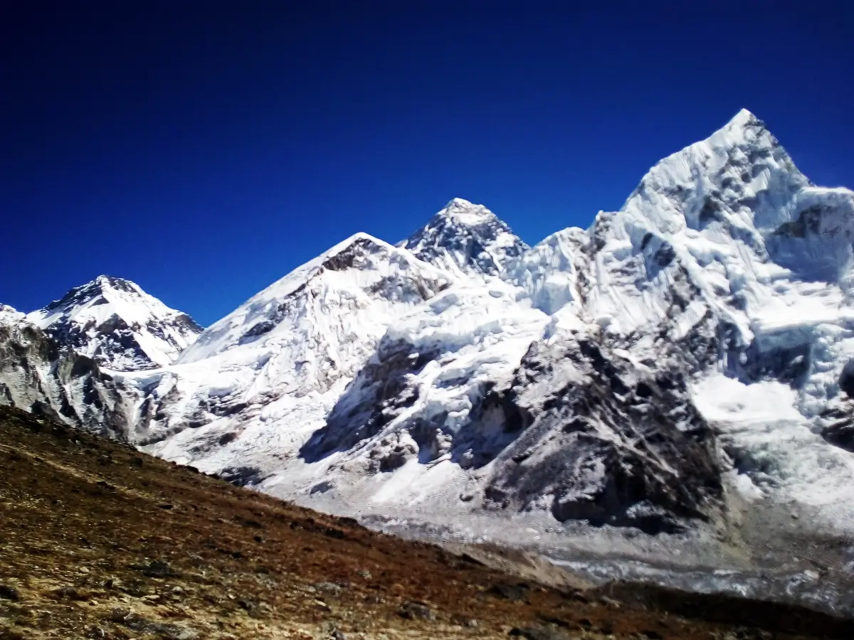
FAQ’s (Frequently Asked Questions)
Where is Mount Everest situated?
MOUNT EVEREST, Mahalangur Himal, Himalaya, 27.9881° N, 86.9250° E, on the border of Nepal and the Tibet Autonomous Region of China.
Mount Everest lies in Nepal. It lies on the border of two countries, Nepal to the south, the Tibet Autonomous Region of China to the north, with the summit itself almost exactly on the border.
Is Everest in Nepal or China?
Both. It’s one mountain, but each country administers its own side with its own permits and access routes.
Is Mount Everest truly open for tourists?
Yes. Most visitors walk to Base Camp from Lukla in about 8–9 days, take a one-day helicopter tour, or fly out of Kathmandu on a scenic route without trekking.
The Everest Base Camps are located at: There are two: South Base Camp in Nepal at 5,364 m on the Khumbu Glacier, and North Base Camp in Tibet at 5,150 m in Tingri County.
In what mountain range is Everest?
The Mahalangur Himal, a subrange of the Greater Himalayas
Why is Everest trapped on a border between two countries?
It rises straight up along the natural watershed ridge that divides Nepal from Tibet . So there is no way to put the whole mountain in one nation 's territory .
How high is Mount Everest?
8,848.86 meters (29,032 feet) above sea level.
Is Everest in a national park?
Yes, on the Nepal side—it is within the Sagarmatha National Park, a UNESCO World Heritage Site since 1979.
What's the nearest city to Everest?
Kathmandu, about 160 km (100 miles) southwest of the peak.
What airport is the closest to Everest?
The southern access is via Tenzing–Hillary Airport in Lukla, Nepal.
Do beginners need to have climbing experience for the Base Camp trek?
There is no technical climbing involved, just a good level of fitness and a sensible, gradual acclimatization schedule for the altitude.
Are tourists allowed to go to the top?
Yes, but that requires a full mountaineering expedition, with technical experience and special permits required—quite a different proposition than the Base Camp trek.
Why is Everest named Sagarmatha?
It is a Nepali name meaning something like "Forehead of the Sky."
Why do they call Everest Chomolungma?
For centuries the Tibetan name—meaning “Goddess Mother of the World”—was used before the English name came along.
What is better to visit, Nepal or Tibet?
By far the more accessible and popular choice, Nepal has stronger infrastructure and easier permits. Tibet is a quieter, more remote alternative for those prepared to sort out visas in advance.
The distance from Everest to Kathmandu is 200 km (124 miles). Everest Base Camp is located about 160 km (100 miles) to the north-east, as the crow flies.
Where does the Everest Base Camp trek start?
The trek starts by flying from Kathmandu to Lukla.
Is Sagarmatha National Park a World Heritage Site?
Yes, since 1979.
Where is Everest Mountain located globally?
The highest peak of the Earth, Mount Everest, is truly a beautiful gift from Mother Nature. Surrounded by other tall peaks such as Lhotse, Nuptse, Cho-Oyu, Ama Dablam, and Changtse, Mt. Everest stands in all its glory amazing trekkers from all over the world. As the tallest mountain on Earth, Mount Everest is a place we all want to know about.
This soaring, majestic peak lies in Nepal and forms a border between Nepal and the autonomous region of China. The latitude of Mount Everest is 27.986065, and the longitude is 86.922623. Located in the Mahalangur sub-range of the Himalayas, Mt. Everest introduces Nepal to the whole world.
What is the Lukla to Mount Everest Base Camp distance?
The total distance from Lukla to Everest Base Camp is a round trip of a full length of 130 kilometers. You will walk about 12 kilometers for around 6 hours on average per day to reach the base camp in 14 days, including the acclimatization days. You will start your trek to the base camp from the only running airport in the Khumbu region, namely, Lukla Airport.
From Lukla, your trek begins as you come across the lush lowlands while you see the icy Himalayas in the background. From Lukla, you will walk until Phakding, which is at 2610 meters. From Phakding, you will trek to Namche Bazar at an altitude of 3441 meters. You have now reached the gateway to the mighty Everest. You will rest at Namche Bazaar to acclimatize for the Everest Base Camp Trek.
You will trek to Tengboche, Dingboche, and Lobuche, and finally reach your destination, Everest Base Camp. Seeing the tallest peak in front of your eyes will surely stir your emotions. The majestic views are your reward for all the long hours of walking through the strenuous trails of the Everest region.
The trek to the base camp of the highest mountain will also offer you opportunities to experience the rich Sherpa culture and lifestyle. Signing yourself up for this trek will surely be a pleasant and heartwarming memory.
How tall is Mt. Everest?
As an already well-known fact, the height of Mount Everest increases every year by 4mm. Scientists and geologists are continually checking the height of the splendid Everest. After the earthquake in 2015, many scientists believed that the height of Everest shrunk, and everyone wanted to scale the height once more.
Despite calculations made by teams from several nations, including Denmark and Italy, China and Nepal recognize 8,848 meters or 20,029 feet as Mount Everest's official height. A Chinese survey from 1875 confirmed this height.
Distance from Everest Base Camp to Summit?
Everest Base Camp located in Nepal is the South Base Camp, and the base camp lying in the autonomous region of Tibet is the North Base Camp. They are the two popular base camps, from where people start their feat to climb Everest. If you are climbing from the South Base Camp in Nepal, the total distance to the summit is 20 kilometers or 12.5 miles. However, if you are climbing from the Tibet side, it is 22 miles.
The total expedition duration from Nepal is 7-9 weeks, with trekkers spending their first week reaching the base camp. In the next 3-4 weeks, trekkers mostly spend their time going up and down from camp to camp in the preparation of food, camps, and oxygen. From camp 4, which is the nearest camp to reach the summit, you will take 4-6 hours to reach the peak of Mount Everest.
Which is the nearest airport to Mount Everest?
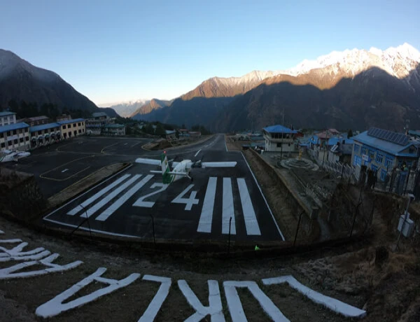
The Everest region, lying on the northeastern side of the country, has only one running airport. This airport in the region is called Lukla Airport or Tenzin Hillary Airport. It is a small airport used to bring in tourists, food, and other essentials for the people living in the Everest region.
Lukla airport is also known as one of the most dangerous airports in the world, as it has a minimum runway length of 527 meters. However, many people prefer to ride on an airplane until Lukla and then start their trek. Because this flight from Kathmandu to Lukla can be a very thrilling and adrenaline-pumping one, many travelers want to try the landing at Lukla airport.
As the only airport in the region, it often fills up with tourists during peak trekking seasons. You might have to wait to book your flight to Lukla during spring and autumn. However, during off-seasons, there aren’t many people going to the Everest region for trekking purposes, so you can book your flight quickly.
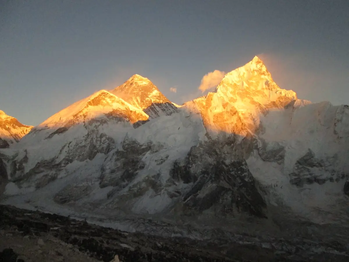
What is the location of Mount Everest in relation to Lukla?
The mesmerizing and breathtaking Mount Everest is located straight north of Lukla. Lukla is both your starting point as well as the ending point of all the treks in the Everest region. Right from Lukla, you can see the breathtaking views of the various mountains.
From Lukla, Mount Everest lies straight ahead to the northernmost side of Nepal. The trails from Lukla to Everest Base Camp pass through rhododendron forests, gushing rivers, and quaint Sherpa settlements. Considered a strenuous trek, you will follow the trail towards the north.
Mount Everest Base Camp Trek: Essential Tips and Information for Your Successful Trip on the Base of Top of the World “Mt. Everest 8,848.86m”
Here is a list of some tips that help to make your trip successful. Kindly go through it.
- Experience the Ultimate Everest Base Camp Helicopter Tour:A Comprehensive Guide
- Daily Bus and Jeep Service from Kathmandu to Lukla: Private and Shared Options Available
- 7 Money-Saving Tips to EnhanceYour Everest Base Camp Trek Experience
- Experience the Adventure of a Lifetime: The Ultimate Guide to Everest Base Camp Trek in 2023-2024
- 14-Day Everest Base Camp Trek Itinerary: A Step-by-Step Guide for a Memorable Journey
- Unlocking the Secrets of Everest Base Camp Trek: Top 7 Insider Tips You Need to Know
- 30 Mind-Blowing Facts About Mount Everest: Discovering the World's Tallest Mountain
- 15 Essential Tipsfor a Safe and Enjoyable Trek to Mount Everest Base Camp
- Lukla Airport: Your Gateway to the Top of the World Adventure
- The Best Time to Trek to Everest Base Camp: A Guide to Choosing the Perfect Season
- Everest Base Camp Elevation: What You Need to Know Before You Go
- How Much Does an Everest Base Camp Trek Cost? A Breakdown of Expenses and Savings Tips
- Getting to Everest Base Camp: A Comprehensive Guide to Transportation and Routes
- Your Ultimate Everest Base Camp Trek Packing List: Essentials and Recommendations
- Kalapatthar: Experience the Best Views of Mount Everest on Your Trek
- Understanding Flights from Kathmandu to Lukla: Why Departure from Ramechhap is Recommended
Where is Mount Everest located on the map?
Mount Everest is located on the Asian continent on the world map. On the world map, you will find that Mount Everest is located between two countries: the Federal Democratic Republic of Nepal and the Autonomous Region of China, which is Tibet.
Located in the Mahalangur subrange of the Himalayas, Mt. Everest borders several other high peaks above the height of 8000 meters. The Mahalangur sub-range is a collection of several mountains on the northeast side of Nepal. It mainly consists of three sections, which are Makalu, Barun, and Khumbu. Among them, the Khumbu region is the best known for accessing the Everest Base Camp.
Where is Mount Everest located, and in what country?
Nepal is a small nation in South Asia. Sandwiched between two great giants, India and China, Nepal is home to some of the tallest peaks in the world. With a total number of 1310 peaks above 6000 meters, Nepal is home to the eight tallest mountains in the world, including the highest, Mount Everest at 8,848.86 meters.
Located in the Mahalangur Himal sub-range of the Himalayas, Mt. Everest is also known as “Sagarmatha” in the Nepali language and “Chomolungma” in the Tibetan language. Mount Everest acts as a border between Nepal and Tibet.
If you require any further information, please feel free to contact Nepal Mother House anytime.