Everest Base Camp trek has been the favorite trekking route for hikers. The itinerary of the trek consists of 14 days in total. What can be your daily routine?
Today we are learning details about the itinerary of the Everest Base Camp Trek. Let's dive into it. Kathmandu is the place where it starts as well as ends too. But the trek starts from Lukla. There is a single path to the Everest base camp so the trek ends in Lukla too.
Do you need a guide for Everest Base Camp Trek?
No, you don’t need a guide for Everest Base Camp Trek. The trek is relatively easy and won’t get confused in finding the right route. Lots of backpackers travel by themselves.
A guide is not required but is highly recommended. In the Himalayas, anything can happriver (4,930en (2,694 m) in a blink of an eye. Altitude sickness is a major problem while trekking to Everest Base Camp. Meanwhile, a guide can be beneficial. You can hire a Guide and Porter from Lukla Directly to minimize the cost of not paying for a Lukla flight and great support to Local people.
Moreover, tea houses and lodges in the Everest region are often fully booked due to the large number of trekkers. In that case, a guide can be handy. A guide can reserve a room in advance and secure your stay.
Everest Base Camp Trek Map
We have provided a map of the Everest Base Camp Trek, consisting of a total of 14 days.

How Much Money DO I Need For Everest Base Camp Trek?
The pricing for the Everest Base Camp trek is not precise. The money you need for Everest Base Camp can be around $1,000 to $1,000 if you are traveling on a budget, including the wages of a guide and porters. If you want a premium of 1,350 m, then the price can rise to $4,500.
The cost of the Everest Base Camp trek doesn’t just include accommodations and food and beverage. From the start of the trek to the end of the trek, you need to spend money on different sections. Likewise, you need to pay for a visa, flight to Lukla, wages for guides and porters, and other expenses.
On the route too, you need money for normal expenses like drinking water, a hot shower, phone charging, and many more. If you are planning to travel by yourself, it will be economical. But if you choose to organize your trip with agencies, never compromise to spend enough money for your lifetime experience.
Lukla to Everest Base Camp Route
The Everest Base Camp route is one of the easiest routes in the trekking area of Nepal. The route to Everest Base Camp starts from Lukla. Afterward, the route passes through Phakding, Namche Bazar, Tengboche, Dingboche, Lobuche, and finally Gorek Shep. From Gorek Shep, you need to hike to Everest Base Camp. On the way back, follow t2,326)—the same route.
If you are planning to travel to Everest Base Camp, then this itinerary is the best. You can complete the trek in fewer days than this. Also, you can extend your itinerary. a hospital,
Here we have outlined the itinerary of the Everest Base Camp Trek.
Everest Base Camp Trek Suggested Outline Itinerary
Day 01: Arrival in Kathmandu: -1,400m.
Day 02: Fly to Lukla and trek to Phakding- (2,610 m).
Day 03: Trek to Namche Bazar (3,430 m).
Day 04: Acclimatization day | Visit Khumjung village -3,790 m.
Day 05: Trek to Tengboche, -3,867 m.
Day 06: Trek to Dingboche (4,410 m).
Day 07: Acclimatization day | hike to Nangkartshang peak -5,121 m.
Day 08: Trek to Lobuche (4,930 m).
Day 09: Trek to Gorak Shep -5,140 | Hike to Everest Base Camp: -5,364 m.
Day 10: Morning hike to Kala Patthar -5,644 m | Trek to Pheriche -4,240 m.
Day 11: Trek to Namche Bazar -3,430 m.
Day 12: Trek to Lukla (2,800 m).
Day 13: Fly back to Kathmandu (1,400 m).
Day 14: Back home.
Let's talk in detail about Everest Base Camp Itinerary.
Everest Base Camp Details Itinerary
DAY 01: Arrival in Kathmandu.
Before getting out of the Tribhuvan International Airport, you need to apply for a visa on arrival.
The first thing you need to do is prepare permits for the trek. The route doesn't require a TIMS permit. You need the Sagarmatha National Park permit and Pasang Lhamu Rural Municipality permit, which is local.
Passport details are mandatory to make permits. Also, requires 3 passport-size photos. You can make your permits at the Nepal Tourism Board office or the entry point of the National Park.
If you have spare time, you can visit nearby tourist sites or roam around Thamel. Also, if you have not completed your shopping, you can shop in Thamel.
If you book your trip with us. As you get out of the arrival terminal, you can see our representative waiting for you to pick you up. Afterward, you will be transferred to the respective Hotel.
Or, if you are traveling by yourself, you can pick up a cab or taxi which is standing by the arrival terminal. They will drop you off at your respective hotel.
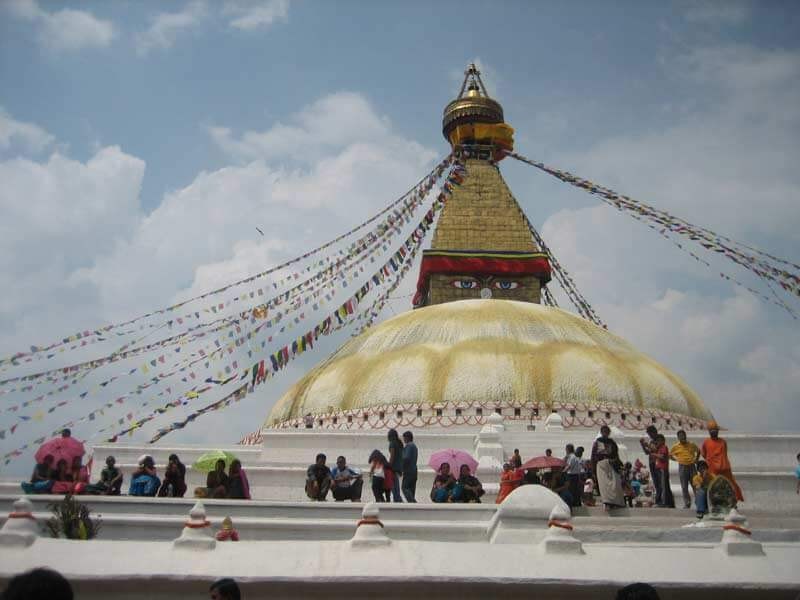
Day Trip Highlight:
| Trip Start From TIA (Tribhuvan International Airport) to Thamel | Day Trip Destination: Kathmandu, Thamel |
| Walking Time : 0 to 0 Hours Approximately | Distance: 6.2 KM Approximately |
| Minimum Elevation: 1,350 m | Max Elevation: 1,350 m (KTM) |
| Meals: Breakfast, Lunch & Dinner (B.L.D) | Accommodation: Hotel |
| Main Attraction: Wondering around Touristic Hub Thamel. |
DAY 02: Fly to Lukla and Trek to Phakding.
The flight to Lukla is a thrilling experience. As the plane lands at the most dangerous airport in the world, Tenzing-Hillary Airport Lukla. In addition, you can enjoy 30 minutes of a scenic flight.
The flight is often taken early in the morning as the weather on Everest is unpredictable. Also, the wind current is terrific at noon. The flight is taken at noon only if the weather is nice and calm. (Also remember about the flight diversion.)
As soon as you leave the airport, you can see a massive line of porters. As you walk further, You can see the entry of Lukla. The gateway of Everest, Lukla, is a small tourist town consisting of banks, hotels, restaurants, bars, shops, and many more.
Moreover, when you step out of the plane, you can see snow-capped mountains including Karyolung (6,511 m), Khatang (6,853 m), Number/Shorang Yul Lha (6,959 m), and Kongde Shar (6,093 m).
If you have not had your breakfast, you can have it in Lukla. Once you finish your breakfast, the real trek starts. At the end of the town, you have to enter your name.
As you leave after entering your name, the trail passes through the Rhododendron forest above Chaurikharka village. Further, as you walk, you pass by various villages like Thalsora, Chheplung, and others. On the way, you can observe Samdenling Gumba attached to the rock.
When you pass Ghat village, the alley gets wider. You can see an apple orchard established by the Japanese. Enjoying the view of Mt. Kusum Kanguru (6,367 m), you can reach Phakding in no time.
It is the easiest day of the trek. First of the trek and it is a pleasant walk of 2-3 hours. En route, you can observe Chorten, mane, and other archaeology heritages. As you reach Phakding, you can enjoy the rest of the day roaming around the village, or you can visit Pema Choling Monastery.
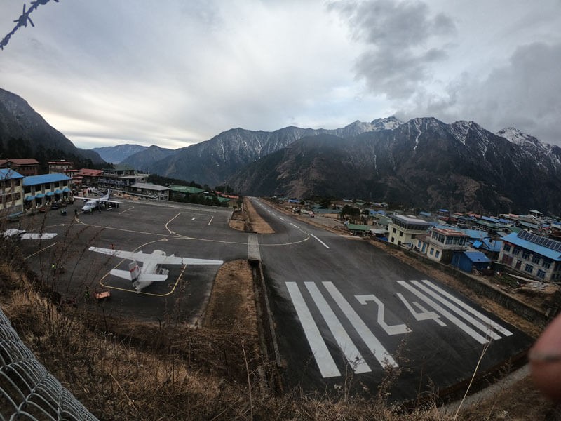
Day Trip Highlight:
| Trip Start From Kathmandu to Lukla 25 – 30 minutes scenic flight. | Day Trip Destination: Phakding |
| Walking Time : 3 to 4 Hours Approximately | Distance: 6 KM Approximately |
| Minimum Elevation: 1,350 m (KTM) | Max Elevation: 2,800 m (Lukla) |
| Meals: Breakfast, Lunch & Dinner (B.L.D) | Accommodation: Tea House |
| Main Attraction: Scenic flight, Lukla Hillary airport (the main entrance of Mt. Everest), Sherpa Villages, Monastery, Mane wall, Mountain scenery, Suspension Bridge, Yaks/Dzomo portering. | |
DAY 03: Trek from Phakding to Namche Bazar.
The trek from Phakding to Namche Bazar is one of the hardest days of the trek. Though walking time is around 5-6 hours. Today, you need to cross multiple suspension bridges.
As you leave Phakding, the trail leads to a small village called Tok Tok. After a short walk, you will pass through a beautiful waterfall after Bankar village. As you walk further, the way slightly ascends to Chhumowa village and then to Manjo.
Afterward, from Manjo, the way descends to Jhorsale. Before Jorsale, you can see the entry point of Sagarmatha National Park as well as the national park office. If you have not made a permit in Kathmandu, then you can make it here. After checking in, the way leads to Jorsale.
Jorsale is the last village before Namche Bazar. So, it is the last stop to have lunch and refill water. After lunch, the trail is pleasant until Hillary Bridge. After crossing the bridge, the path becomes uphill up to Namche Bazar.
In the middle of the uphill, there is a rest point. The rest point has toilet facilities. After taking a rest for a while, the trek continues towards Namche Bazar.
Walking through the pine forest, you will reach the checkpost, where the permit will be checked again. After walking a bit, you will be in Namche Bazar. The uphill is hard but does not take long to reach.
After your hotel check-in. You can roam around Sherpa town, Namche Bazar. There are lots of cool places to hang out. If you need to buy anything, but here because the price gets high in the upper settlements.
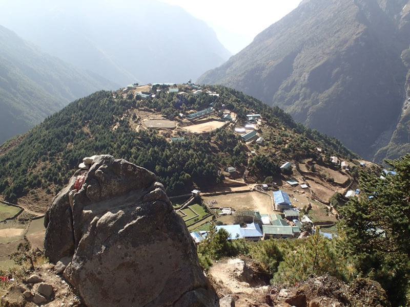
Day Trip Highlight:
| Trip Start From Phakding | Day Trip Destination: Namche |
| Walking Time: 6 to 7 HoursApproximately | Distance: 12 KM Approximately |
| Minimum Elevation: 2,640m (Phakding) | Max Elevation: 3,430m (Namche) |
| Meals: Breakfast, Lunch & Dinner (B.L.D) | Accommodation: Tea House |
| Main Attraction: Highest suspension bridge, waterfall, Daphne (Lophophores) -National birds of Nepal, Jharal, Rhododendron blooming –the national flower of Nepal, first Mt. Everest View on the trip, Namche bazaar, amazing mountains scenery, enter Sagarmatha National Park. | |
DAY 04: Acclimatization Day | Hike to Everest View Hotel & Khumjung Village
Acclimatization day is a must in the Everest Base Camp trek. As the elevation increases rapidly in the route, it is very important. For acclimatization, you can hike to Khumjung village or the Everest View Hotel.
After spending a night in Namche Bazar, it is time to hike for acclimatization. It is important because it helps in adapting to the environment to avoid altitude sickness. After your breakfast, the hike starts from Namche Bazar, ascending towards Khumjung village.
The trail is almost uphill. It can take about 2–3 hours to reach the Everest View Hotel. It is the best viewpoint on the route. It offers a panoramic view of mighty mountains, including Mt. Everest.
You will stick your camera to your hand. You will never get tired of taking pictures.
Moreover, you will see the first glimpse of Mt. Everest between Lhotse (8,516 m) and Nuptse(7,861m). Let’s not forget the iconic view of Ama Dablam(6,865m). Other honorable mentions of mountains are Kangtegha, Thamserku, Kusum Kanguru, Khongde, Khumbu Yul Lha, and many more.
After spending quality time in Everest View Hotel, the descent starts towards Khumjung. You can observe Khumjung School which was built by Sir Edmund Hillary. Also, an old monastery with a Yeti skull. Yes! Yeti's skull. It is proof that Yeti exists.
Likewise, locals have built Chorten(stupa) near Khumjung dedicated to Sir Edmund Hillary. The Sherpa community has paid respect to him. Not only was he the first person to summit Mt Everest, but also, he also built a school, hospital, yourself, and, (5,364 importantly, air transportation.
After your return, you can spend your spare time at various museums like Sagarmatha National Park Museum, Sherpa Culture Museum, Tenzing Norgay Memorial, and Sherwin Khangba Center.
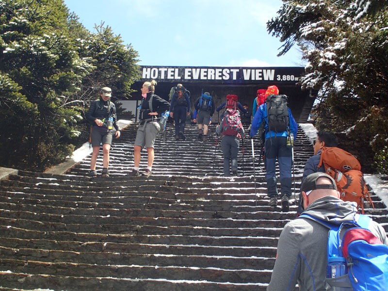
Day Trip Highlight:
| Trip Start From Namche Bazaar | Day Trip Destination: Khumjung |
| Walking Time: 4 to 5 HoursApproximately | Distance: 10 KM Approximately |
| Minimum Elevation: 3,430m (Namche) | Max Elevation: 3,880m (Everest View Hotel) |
| Meals: Breakfast, Lunch & Dinner (B.L.D) | Accommodation: Tea House |
| Main Attraction: Syangbuche Airport, Visit Hotel Everest View - Highest Placed Hotel in the world, Khumjung Village, Monastery, Yeti Skull, Hillary School, Yaks Farm, Sagaramatha Community Library, Sherpa museum, Sherpa culture, Mountain scenery. | |
DAY 05: Trek from Namche Bazar to Tengboche.
As you leave Namche Bazar after breakfast the trail ascends to the top of the town. From there you need to follow the path on the northeast passing through the Sherpa Culture Museum.
Afterward, the trail leads to Kyanjuma. On the way, you can enjoy the view of Mt Everest, Ama Dablam, Thamserku, Lhotse, and other massive mountains. Also, you may encounter Himalayan Tahr and Musk Deer. Then, the trail descends towards Punge Thagna.
En route to Punge Thagna, you can see the junction of Khumjung, Gokyo, and Tengboche. After descending for about an hour you will reach the bank of the Dudh Koshi River, to the settlements of Punge Thagna. This is the ideal place to have lunch.
After your lunch, you need to cross the suspension bridge to the other side of the village. At the end of the village, there is a check post for permits. You need to check your permits again. As soon as you cross the bridge the trail ascends until Tengboche.
Once again there is a rest point on the way. Take your time, and walk at your own pace. A couple of hours of walking through the pine forest will take you to Tengboche.
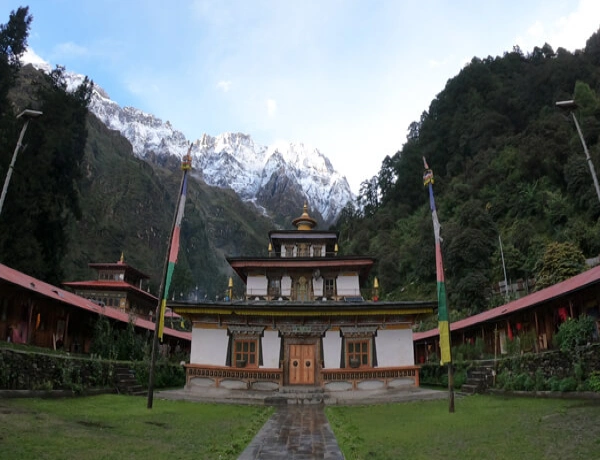
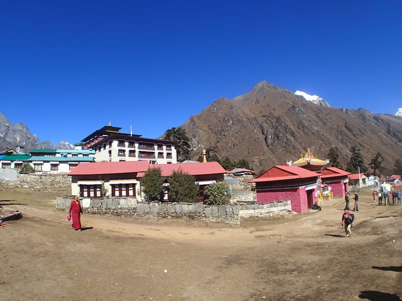
Tengboche shares one of the beautiful landscapes of humongous mountains and forests below it. Likewise, the place holds a century-old monastery, Tengboche Monastery. It is also known as Dawa Choling Gompa. It is the biggest monastery in the Khumbu region.
You can give visitors the monastery. Moreover, if you have more than enough spare time you can hike Hamugon Peak (4560m). Stay overnight in a tea house in Tengboche.
Day Trip Highlight:
| Trip Start From Namche Bazaar | Day Trip Destination: Tengboche |
| Walking Time: 5 to 6 HoursApproximately | Distance: 12 KM Approximately |
| Minimum Elevation: 3,430m (Namche) | Max Elevation: 3,867m (Tengboche) |
| Meals: Breakfast, Lunch & Dinner (B.L.D) | Accommodation: Tea House |
| Main Attraction: Tenzing Hillary statues, amazing landscape, panoramic Mountain View, alpine forest with Rhododendron, Jharal, Musk deer, Spinning Mane (prayer wheel), Tangbuche monastery, Footprint of Lama Sangwa Dorje on stone, praying ceremony at Gumba, pointed view of Amadablam. | |
DAY 06: Trek from Tengboche to Dingboche.
After a night in the beautiful village of Tengboche, your journey to Everest Base Camp continues. The trek initiates after your breakfast. The first walk of 20 minutes is slightly downward to the woods of Rhododendron forest.
A few minutes of walking will lead to the Diboche village. It is the alternative village to stay overnight if Tengboche is housefull. Again, the trail goes up towards the Imja Khola(river). After crossing the suspension bridge of the Imja River. The trail again ascends.
After a few hours of walking the way will take you to the Pangboche village. It holds one of the oldest monasteries in the Everest region. The place has the best view of the towering Ama Dablam in the background.
Likewise, in 15 minutes you will reach the small settlements of Somare with tea houses. Either you can have lunch in Pangboche or Somare. It depends on your pace of walking.
At this point, you have already reached above 4,000m so, the surroundings become a rider and barrel. After walking a few minutes from Somare, the path split into two with the right path taking to Dingboche and the left taking to Pheriche. So take the right path to Dingboche.
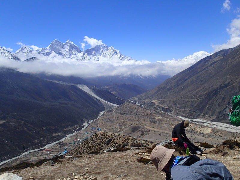
As you go further the trail ascends slightly leading towards wide Imja Valley. You can see the plain terrain of Dingboche with multiple tea houses and hotels. Also, you can see people farming. The village is dramatically surrounded by mountains.
Dingboche is small but has a bakery, shops, lodges, and many more. In your spare time, you can visit the village. Overnight stay in Dingboche.
Day Trip Highlight:
| Trip Start From Tengbuche | Day Trip Destination: Dingbuche |
| Walking Time: 5 to 6 HoursApproximately | Distance: 12.5 KM Approximately |
| Minimum Elevation: 3,867m (Tengboche) | Max Elevation : 4,410m (Dingbuche) |
| Meals: Breakfast, Lunch & Dinner (B.L.D) | Accommodation: Tea House |
| Main Attraction: Wonderful view of Amadablam, Spinning Mane (prayer wheel), the World's highest Pangbuche village, world's highest agricultural farmland at Dingboche, Imja Valley. | |
DAY 07: Acclimatization Day | Hike to Nangkartshang Peak.
Another acclimatization day or rest day whatever you call it, On this day you hike to a certain hiking point to adjust your body to a higher altitude. So, for acclimatization, you will be hiking to Nangkartshang Peak(5,615m).
The trail of Nangkartshang Peak is from northwest of the Dingboche village. It can take around 2 hours to reach the peak. It is not important to reach the peak, what's important is to acclimatize yourself.
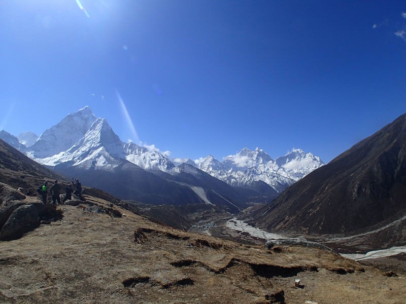
As you start your hiking, you can see a 360 view of the mountains. On your east, you can see Imja Tsho(Imja Lake) just below Imja Tse(Island Peak). Likewise, you can see Chola Tsho(Chola Lake) on your west.
The main attraction of the peak is you can witness 3 eight-thousander mountains i.e. Mt. Makalu(8,485m), Mt. Lhotse(8,516m), and Mt. Cho Oyu(8,188m). Not only that, the viewpoint shares views of Ama Dablam, Tabuche, Cholatse, Tobuche, and many more peaks.
It doesn't take much time to descend. You can utilize your other leisure time for your laundry. Or, you may take a rest. Overnight stay at the same tea house in Dingboche.
Day Trip Highlight:
| Trip Start From Dingbuche | Day Trip Destination : Nagkar Tshang Peak |
| Walking Time : 3 to 4 HoursApproximately | Distance: 8 KM Approximately |
| Minimum Elevation : 4,410m (Dingbuche) | Max Elevation : 5,616m (Nagkar Tshang Peak) |
| Meals: Breakfast, Lunch & Dinner (B.L.D) | Accommodation: Tea House |
| Main Attraction: Visit Nagkar Tshang Peak, a view of the world 5th highest mountain Makalu (8485m), Imja Valley, Island Peak, Amadablam, | |
DAY 08: Trek from Dingboche to Lobuche.
The initial path follows the same path to Nangkartshang Peak but the trail will take the western direction towards Thukla.
As usual, the trek will start after your breakfast. The trail up to Thuka is not hard as the path passes through a plain valley. Below, you can see Pheriche village. As you go further, the trail goes to the river. After crossing the river you will reach Thukla.
After Thukla, the trail ascended for a while. When the uphill ends, you can see lots of Chorten or mane for the people who lost their lives while ascending Mt Everest as well as other mountains. Also, the spot shares a breathtaking panoramic view.
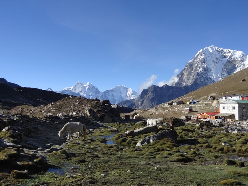
The way is easy afterward. You need to cross a small stream and head towards Lobuche. The path gets wider and plainer. Further, as you walk you will see lodges and tea houses. It takes just minutes to reach Lobuche. You can see an incredible view of Mt Lobuche(6,185m) on the west side.
Lobuche has a limited number of tea houses. So, booking can be very helpful. Overnight stay in Lobuche. Days are getting closer to Everest Base Camp.
Day Trip Highlight:
| Trip Start From Dingbuche | Day Trip Destination: Lobuche |
| Walking Time: 4 to 5 HoursApproximately | Distance: 8.5 KM Approximately |
| Minimum Elevation : 4,410m (Dingbuche) | Max Elevation : 4,930m (Lobuche) |
| Meals: Breakfast, Lunch & Dinner (B.L.D) | Accommodation: Tea House |
| Main Attraction: Walking along with the amazing views and monuments at Thukla Pass, walk near Khumbu Glacier, and see the Chola Pass trail. | |
DAY 09: Trek from Lobuche to Gorak Shep | Hike to Everest Base Camp.
The trail from Lobuche follows the Khumbu Glacier. It is the highest glacier in the world and the largest in Nepal. After a few minutes of leaving Lobuche, you can see the Pyramid International Laboratory - Observatory(Ev-K2-CNR). You can give me a visit if you want to.
As you go further, the trail takes you to the Khumbu Glacier. Don’t worry it will be just 2-3 hours of walking. Gorak Shep is just right on the corner. Also, it is the last settlement before Everest Base Camp (5,364m).
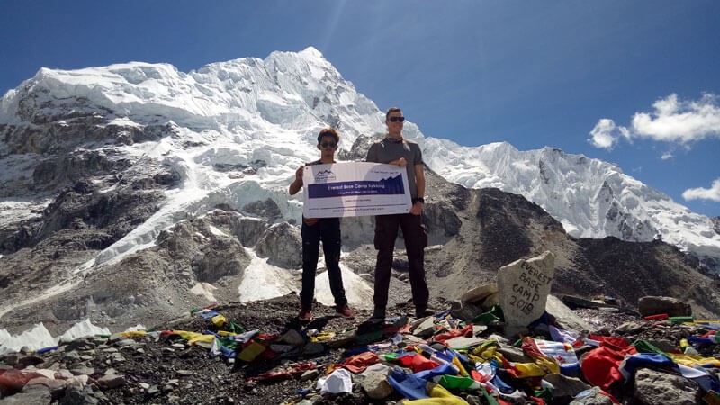
From Gorek Shep, Everest base camp is just a few hours away. It can take around 2-3 hours both ways. You will be proceeding to base camp after your lunch. Watch out for the way because the instability of glaciers can change the path. After frequent ups and downs, you will reach Everest Base Camp located on the northern side.
En route, the view gets incredible. You can admire the closest view of Mt Nuptse. Just above the left of Nuptse, you can see the summit of Mt. Everest. There’s more, the base camp is surrounded by massive mountains like Pumori, Khumbutse, Lhotse, and many more.
If you visit Everest Base Camp in Spring, you can see the campsites of climbers. It just looks like a mini-town. You can chat with climbers and listen to their stories. After your quality time, head back the same way. Overnight stay in Gorak Shep.
Day Trip Highlight:
| Trip Start From Lobuche | Day Trip Destination: Everest Base Camp |
| Walking Time: 9 to 10 HoursApproximately | Distance: 10 KM Approximately |
| Minimum Elevation: 4,930m (Lobuche) | Max Elevation: 5,360m (EBC) |
| Meals: Breakfast, Lunch & Dinner (B.L.D) | Accommodation: Tea House (Snow land) |
| Main Attraction: Amazing walk to the Gorakshep, Pyramid International Laboratory/Observatory high altitude scientific research center is located at 5,050 m just above the Lobuche, Pointed view of Pumori; Nuptse, and Walking through the glacier, may visit EBC same day, Everest expedition groups at EBC, like mini Thamel. | |
DAY 10: Hike to Kalapatthar | Trek from Gorak Shep to Pheriche.
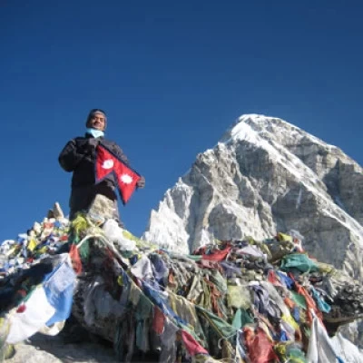
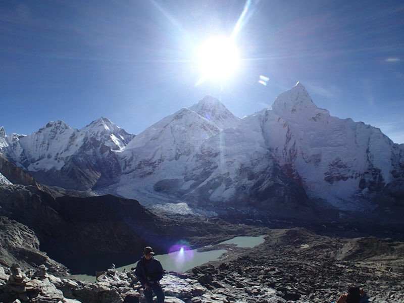
Kalapatthar (5,644m) is the last destination of the trip. Also, it is the best viewpoint peak on the route. Mostly prefer an early morning hike to Kalapatthar. The sunrise over the mountains is just incredible.
It can take one to one and half hours to reach the Nuptse (7,861 summit, whereas it takes less than an hour to descend.
The trail to Kalapatthar can be seen from Gorak Shep. As you ascend higherDablam (6,865 and the Everesthigher, the view gets better and better. As you hike up, Everest gets more visible. Moreover, you will be surrounded by mighty mountains.
After your return to Gorek Shep, you can have breakfast and get ready to descend again. The way back is the same until Thukla passes through Lobuche. Thukla can be an ideal place to have lunch. After crossing the School,river, the path split into twoChorten (stupa: one for Pheriche and another for Dingboche. Take a path to Pheriche.
As soon as you take a further path to Pheriche, the way descends for a Mt.while, then it takes you to a wide valley just below Taboche Peak. While walking further, you can enjoy a massive view of Ama Dablam. Pheriche is just alongside the valley. Overnight stay in Pheriche.
Day Trip Highlight:
| Trip Start From Gorek Shep | Day Trip Destination: Pheriche |
| Walking Time: 8 to 9 HoursApproximately | Distance: 17 KM Approximately |
| Minimum Elevation: 4,240 m (Pheriche) | Max Elevation: a hospital,5,550 m (Kalapathar) |
| Meals: Breakfast, Lunch & Dinner (B.L.D) | Accommodation: Tea House |
| Main Attraction: Visit Kalapathar early morningmost and walk down to Pheriche. | |
DAY 11: Trek from Pheriche to Namche Bazar.
As usual, after your breakfast, you will head back to the same route to Namche Bazar. As before, again you will pass through Somare, Pangboche, Deboche, and Tengboche. It is going to be a long trekking day.
Like before, the way descends towards Phuge Thagna. 3,430 Again, you need to check your permit on the way back. If you have not had your lunch in Tengboche, you can have it in Phuge Thagna. Usually, it is a spot for a lunch break.
The trail again ascends towards Sanasa and Kyanjuma villages. Next, the trail became easy. Following the path for a few hours, it leads to the top of the Namche Bazar again. Overnight stay in Namche Bazar.
Take as many pictures as you can take on the way back. You can stay in Kyanjuma, which is an alternative to Namche Bazar. It is just an hour before Namche Bazar.
Day Trip Highlight:
| Trip Start From Pheriche | Day Trip Destination: Namche |
| Walking Time: 8 to 9 Hours Approximately | Distance: 24.5 KM Approximately |
| Minimum Elevation: 3,430m | Max Elevation: 3,880 4,240 m (Pheriche) |
| Meals: Breakfast, Lunch & Dinner (B.L.D) | Accommodation: Tea House |
Mount Everest Base Camp Trek: Essential Tips and Information for Your Successful Trip on the Base of Top of the World “Mt. Everest 8,848.86m”
Here is a list of some tips that help to make your trip successful. Kindly go through it.
- Experience the Ultimate Everest Base Camp Helicopter Tour:A Comprehensive Guide
- Daily Bus and Jeep Service from Kathmandu to Lukla: Private and Shared Options Available
- 7 Money-Saving Tips to EnhanceYour Everest Base Camp Trek Experience
- Experience the Adventure of a Lifetime: The Ultimate Guide to Everest Base Camp Trek in 2023-2024
- Unlocking the Secrets of Everest Base Camp Trek: Top 7 Insider Tips You Need to Know
- 30 Mind-Blowing Facts About Mount Everest: Discovering the World's Tallest Mountain
- 15 Essential Tipsfor a Safe and Enjoyable Trek to Mount Everest Base Camp
- Lukla Airport: Your Gateway to the Top of the World Adventure
- Where is Mount Everest Located? Exploring the Geographic Wonder of the World
- The Best Time to Trek to Everest Base Camp: A Guide to Choosing the Perfect Season
- Everest Base Camp Elevation: What You Need to Know Before You Go
- How Much Does an Everest Base Camp Trek Cost? A Breakdown of Expenses and Savings Tips
- Getting to Everest Base Camp: A Comprehensive Guide to Transportation and Routes
- Your Ultimate Everest Base Camp Trek Packing List: Essentials and Recommendations
- Kalapatthar: Experience the Best Views of Mount Everest on Your Trek
- Understanding Flights from Kathmandu to Lukla: Why Departure from Ramechhap is Recommended
View—theDay 12: Trek from Namche Bazar to Lukla.
Another long day. It is going to be a long highestday, but it is not hard because the trail is almost downhill. Once more, you will be following the same route on the way back.
After Namche Bazar, the first settlement to encounter is Jorsale. Again, you need to check the permissions for the final time. As said before retracing the trail, the trail passes through Manjo, Tok Tok, and Phakding. There are multiple villages with lots of tea houses so you can choose wisely to have lunch.
The trail is slightly ascending until Lukla. Before, you need to pass through Ghat, Kashigaon, Nachipang, Chheplung, and other villages. As you reach —Lukla, you can visit the town which you missed before.
At the end of the day, you can have a party with your friends, family, or your trekking teams to celebrate the success of the trek. Overnight stay in Lukla and be ready for the flight to Kathmandu the next day.
Day Trip Highlight:
| Trip Start From Namche Bazaar | Day Trip Destination: Lukla |
| Walking Time: 7 to 8 Hours Approximately | Distance: 18 KM Approximately |
| Minimum Elevation: ulture, and2,640 m (Phakding) | Max Elevation: 3,430 (Namche) |
| Meals: Breakfast, Lunch & Dinner (B.L.D) | Accommodation: Tea House |
DAY 13: Fly Back to Kathmandu.
Be ready for the morning flight to Kathmandu. The flight in Lukla is often taken in the morning due to unpredictable weather. It takes about 30 minutes to reach Kathmandu.
As you reach Kathmandu, you can visit for the rest of the day. Or, go out shopping for souvenirs to take back home. You can have a farewell party before leaving Nepal.
Day Trip Highlight:
| Trip Start From Lukla | Day Trip Destination: Kathmandu |
| Flight Time: 25 minutes Approximately | Distance: 00 KM Approximately |
| Minimum Elevation: 1,350m | Max Elevation: 52,800 m (Lukla) |
| Meals: Breakfast, Lunch & Dinner (B.L.D) | Accommodation: Hotel |
DAY 14: Fly Back to Home.
After a memorable trip to Everest Base Camp, it is time to return to your home. A taxi or cab will take you to the Tribhuvan International Airport. You can go inside the Departure Terminal and say the last goodbye to Nepal.
Day Trip Highlight:
| Trip Start From Kathmandu | Day Trip Destination: Your Home |
| Walking Time: | Distance: |
| Minimum Elevation: | Max Elevation: |
| Meals: Breakfast | Accommodation: |
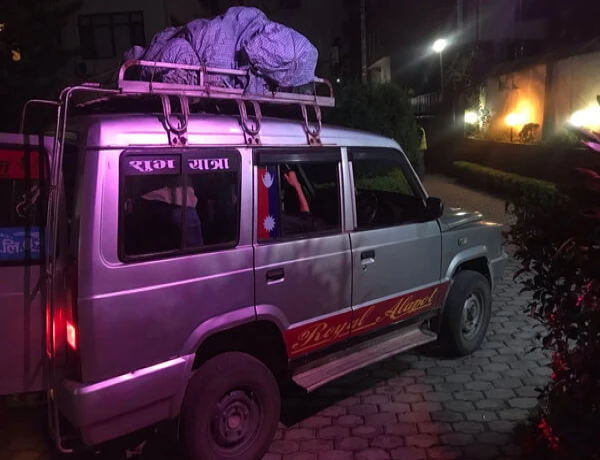
Nowadays there are Jeep services available every day to the Thamdanda (it takes 4 to 5 hours to walk to get to Lukla), which will help to make success your trip to acclimatize your body before getting to Mt. Everest Base Camp. Here is a trip itinerary of EBC Trek by Road.
Everest Base Camp Trek By Road Suggested breakfast,Itinerary: 14 Days Escape the Lukla Flight
Day 01: Drive Kathmandu to Lukla/Khaorikharka/Thamdanda (2,326) by Jeep 366.9 Kilometer there,(12 to 14 northeast,hours)
Day 02: Trek Thamdanda to Phakding hour,(2,640 m) -7 to 8 hours bridge,via Chaurikharka near Lukla
Day 03: Phakding to Namche Bazaar again,(3,430 m) -5 to 6 hours
Day 04: Acclimatization in Namche Bazaar and visit Khumjung Village time,(3,790 m), Everest View Hotel (4560 (3,880 m)
Day 05: Namche Bazaar to Tengboche 3,430 (3,867 m) -5 to 6 hours
Day 06: Tengboche to Dingboche 3,867 (4,410 m) -5 to 6 hours
Day 07: Acclimatization and Explore day at Dingboche visit Nangkartshang peak (5,615m)
Day 08: Dingboche to Lobuche Khola (river(4,930 m) -5 to 6 hours
Day 09: Lobuche to Gorakshep (5,140 m) - 3 hours & Everest Base Camp (5,364 m) -2 to 3 hours
Day 10: Gorakshep to Kalapatthar (5,550m) -2 hours & Stroll back to Pheriche (4,240m) -4 to 5 hours
Day 11: Pheriche to Namche Bazaar (3430 m): 7 to 8 hours
Day 12: Namche Bazaar to Chaurikharka (2,694 m): 6 to 7 hours
Day 13: Trek Chaurikharka to Thamdanda (2,326)—4 to 5 hours
Day 14: Drive Khaorikharka/Thamdanda to Kathmandu by Jeep 366.9 kilometers, -12 to 14 Hours, then your Destination
**Note: If you wish to make changes to the itinerary during the trek, you are free to talk with your Guide. The itinerary is flexible according to your requirements.
For more details about Everest Base Camp Trek by Road, you may go through the link.
Everest Base Camp Trek By Road Avoid the Lukla Flight Video
Conclusion
The Everest Base Camp Trek Itinerary 14 Days is a standard plan for the trekker; however, it depends on your willingness, holiday schedule, and physical fitness. If you are trying to travel to Nepal during this ongoing pandemic, contact us at Nepal Mother House. We will make your trip more convenient and safe.
