Bus Service to Machhikhola Resumes After Flood Disruption
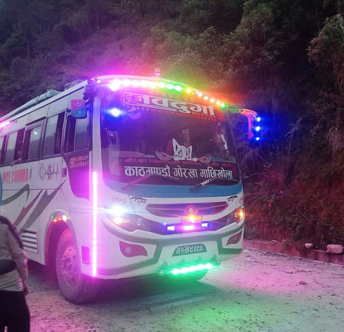
Gorkha, October 16, 2026 (RSS): Bus services have resumed today to Machhikhola, the administrative center of Dharche Rural Municipality in Gorkha District, restoring a vital road link just as Dashain, Nepal’s biggest festival, is underway.
A bus from Kathmandu reached Machhikhola today after passing through Gorkha Bazaar, Aarughat, Arukhet, and Soti. The service will be easier for travelers heading home for the festival when it resumes.
Repair work on the road sections has also begun beyond Machhikhola and Khorlabesi. On October 12, the flood of the Budhi Gandaki River damaged riverside roads in the areas of Dharche and Chumnubri.
The flood originated at Chamar Himal and Syerangi (Siringi) Himal, at an elevation of about 5,500 meters, at 4:20 AM on October 11, 2026, and flowed through the Ungilung Khola (stream) between Lokpa and Chumling and Chumchet in the Chumnubri Rural Municipality-6, Gorkha.
The first landslide released an amount of energy equivalent to a magnitude 3.5 earthquake. Mud, water, rocks, and glacial debris created a natural dam in the main stream of the Budhigandaki River near Lokpa. Later, at 6:30 AM, a massive flood wave 20 to 25 meters high slammed Salleri, Tatopani. The flash flood in northern Gorkha caused extensive damage, washing away some 45 houses, destroying at least four bridges (including two motorable, two suspension, and one Bailey bridge), and heavily damaging three hydropower projects. Several sheep and four people living at the foot of Siringi Himal were missing, and 82 individuals, including 9 foreigners, were aerial rescuers.
Officials of Dharche Rural Municipality and residents say the work to reopen the Manaslu Circuit trekking trail is moving fast.
Has the Arughat Bazaar Bailey bridge been rebuilt?
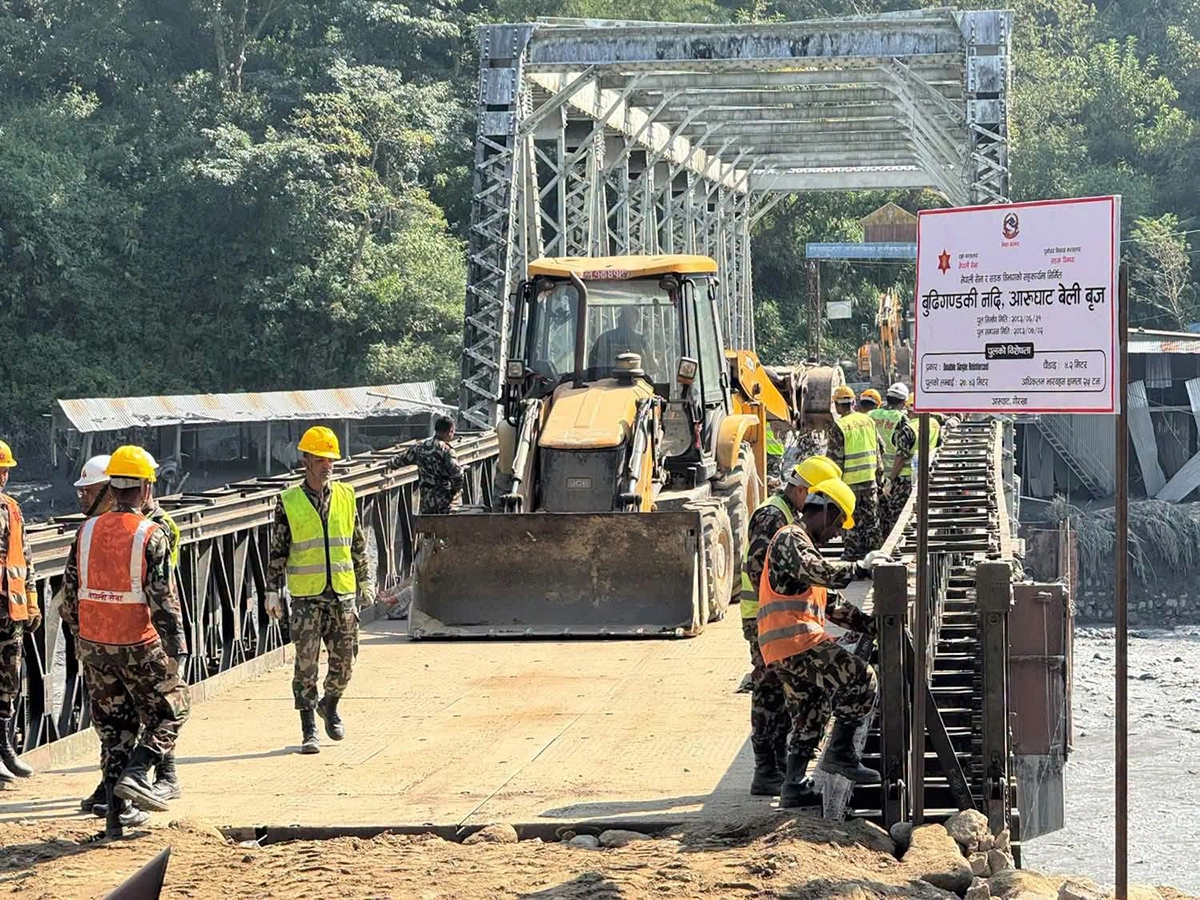
Good news! The most important 27.43-meter Bailey bridge to Arughat Bazaar has been installed today by the Nepal Army, October 19, 2026, after 9 days of flash flooding in Budhigandaki. The bridge has a maximum of 25 tan load efforts; however, light vehicles and two are testing for its capability. The bridge again connects people from the Gorkha and Dhading districts during the Dashain festival season, allowing them to reach the Tsum Nubry village area in Manalsu.
Are the Khorlabesi to Tatopani and Jagat Trails open?
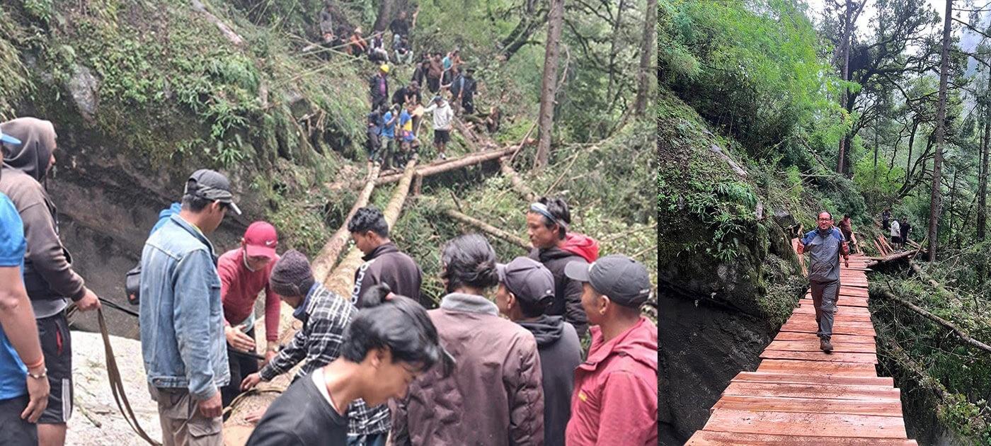
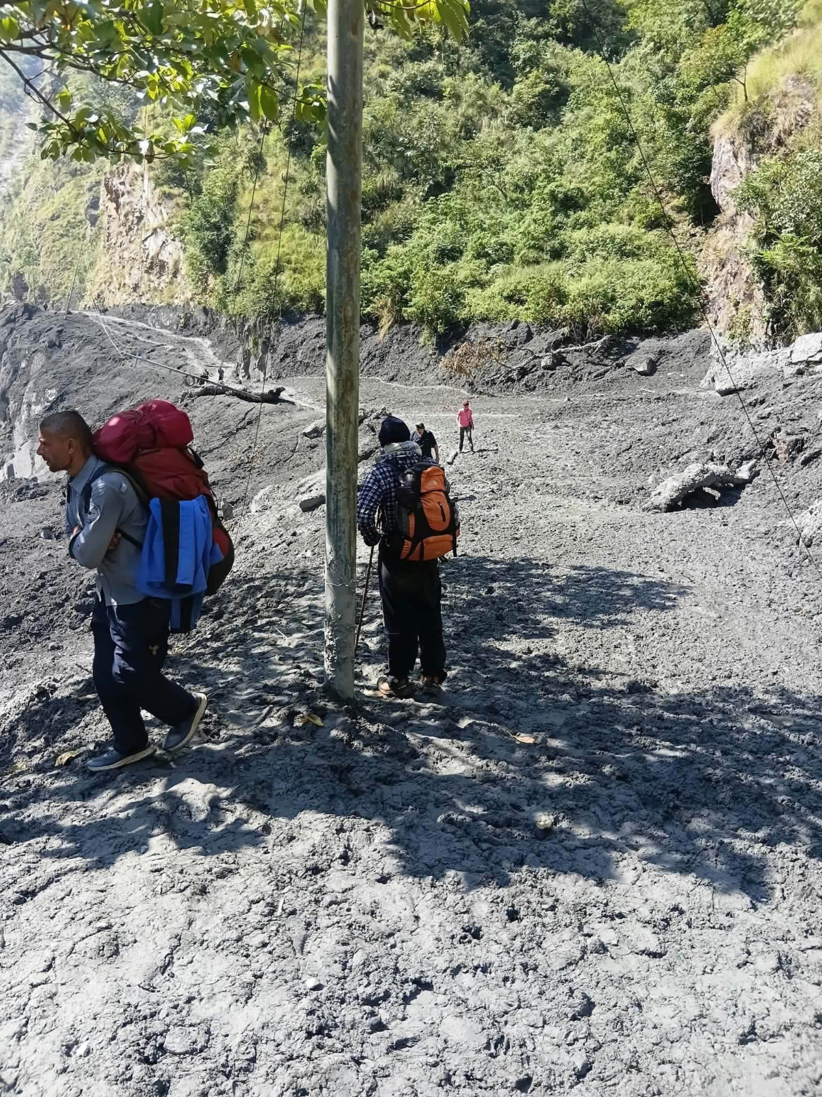
Flash floods badly damaged the stretch from Khorlabesi to Tatopani and Jagat. Local people in Machhikhola, Jagat, and Philim are removing the debris and repairing the route to enable trekkers to use it again at the earliest. However, from 18th October 2026, some trekkers are heading to the Manaslu circuit trek using the newly opened alternative trail from Khorlabesi to Jagat. The road division of Gorkha and local people are also working hard to fix the main road to Tatopani and Jagat, and we believe it will be completed soon.
Tsum Valley Trail Update?
Similarly, the Tsum Valley Trail between Lokpa and Chumling was also badly hit by the flood; the trail was washed away, and the cantilever bridge was swept away. This is Ungilung Khola (stream), where an originating landslide is coming from Siringi Himal. The local people from Chumling, Chhekamparo, Chule Nele, and Lokpa, Philim, are rapidly working to rebuild the trail collaboratively with the local government.
Gorkha, Oct 22: Landslides and floods blocked the trekking trail to the Tsum Valley in north Gorkha, and workers are now repairing it. Work is underway to get the trail back open in the coming days.
Traffic between Chumchet and Chhekampar has come to a complete halt after a cantilever bridge at Sardibhir, in Chumnubri Rural Municipality–6, was washed away by floodwater. “We are preparing to construct a temporary wooden bridge at the same location to restore the access,” said Chairperson of Chumnubri Rural Municipality Nima Lama.
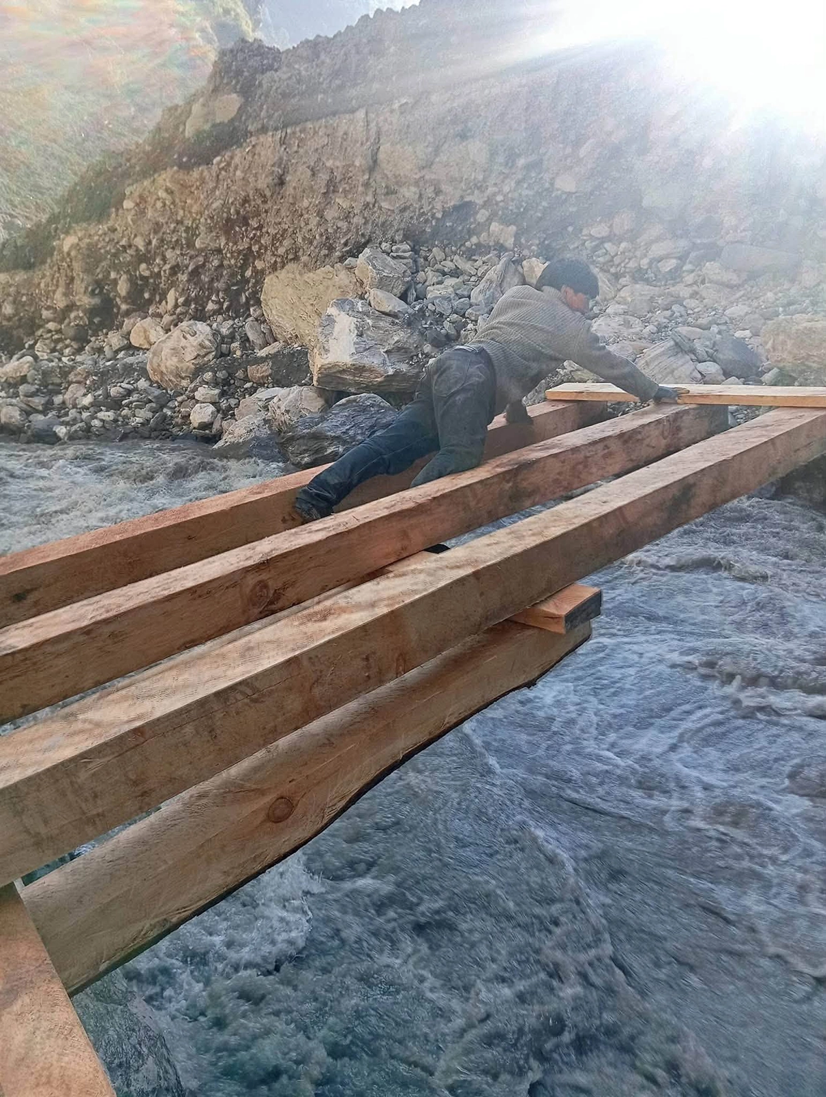
“The flood damaged the cantilever bridge over Syar Khola, a tributary of the Budhi Gandaki River," he said. “Work is underway to set up a wooden bridge to allow movement along the route.
Mr. Lama also said there would be a total of four wooden bridges installed. These bridges will facilitate the reopening of the trekking trail to Tsum Valley. It will be complete in about 10 days, and then Tsum Valley Trekking will also be open for the trekkers. The necessary repairs have been done on the trekking trail. “When the wooden bridges are in place, the trail to Chhekampar will be reopened," he said.
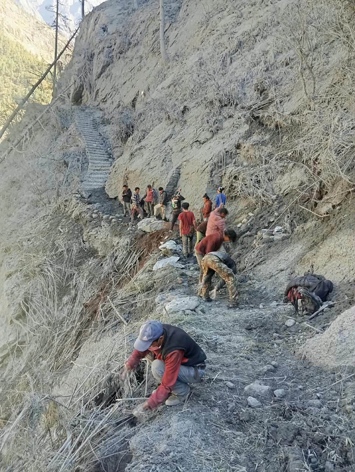
Can we go on the Manaslu Circuit Trek?
Yes, you can go on the Manaslu Circuit Trek; now the main trail has also resumed on 21st-October-2026. Several trekking groups are walking along the bank of the Budhigandaki River from Kholrabesi to Tatopani and Jagat now that the water level has dropped. The trekkers are already using the newly opened alternative trail from Khorlabeshi to Tatopani and Jagat on 18 October 2026. But now, you can walk the main trail; however, as this is a rebuilt trail, you must be physically and mentally well prepared to walk this new trail with adventure.
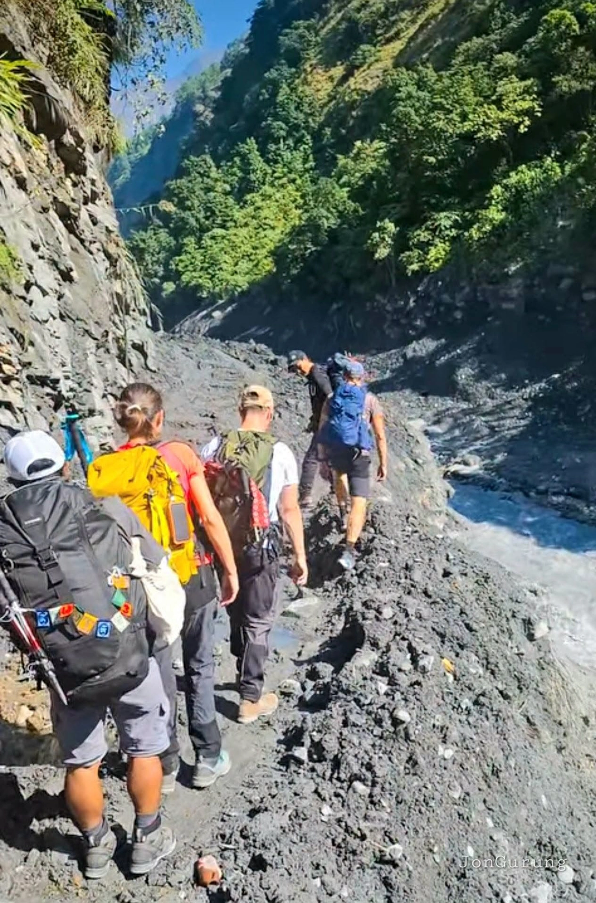
Manaslu Circuit Reopening With Alternate Trail Route: What Trekkers Need to Know (September 2026)
Quick answer: Yes—the Manaslu Circuit Trek is open again. A flash flood destroyed the main Budhi Gandaki bridge near Namrung on September 6, 2026, but local communities rebuilt a temporary crossing within days, and the trail toward Samagaun and Larkya La is walkable again. Here's what changed, what stayed the same, and what to actually check before you book.
What Happened Near Namrung
On September 6, 2026, a flash flood tore through the Therang Khola, a tributary that feeds into the Budhi Gandaki River near Namrung, in Chumnubri Rural Municipality-4, Gorkha district. The flood took out the main suspension bridge over the Budhi Gandaki along with a second nearby crossing. The flood also damaged several homes and two micro-hydropower plants. Remarkably, no injuries were reported—a detail worth sitting with, given how fast these floods move through narrow Himalayan gorges.
For a trek that routes almost every trekker through this exact corridor on the way to Samagaun and the Larkya La pass, a lost bridge here isn't a minor detour. It's the kind of disruption that, a decade ago, might have closed the route for a full season. That's not what happened this time.
How the Trail Reopened So Fast
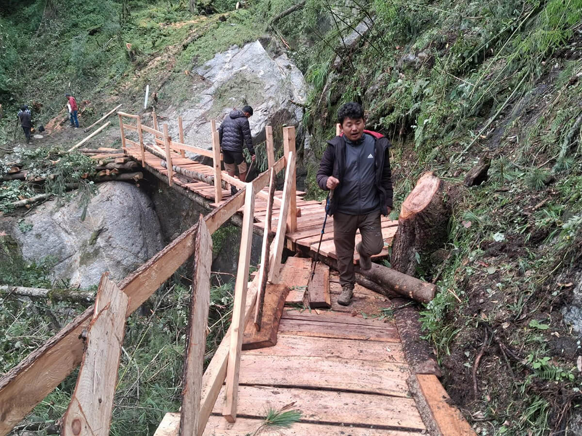
Under Ward Chairperson Pema Gyalpo Lama, the community in Chumnubri didn't wait for external contractors or government engineering teams. The Manaslu Conservation Area Project (MCAP) and local stakeholders rapidly built the bridge using local builders, who used indigenous construction knowledge and hand-cut timber to put up a temporary log crossing at Suksum, alongside a rerouted footpath through Therang and Syabari. Within days, movement toward Namrung, Samagaun, and Larke (Larkya) Pass was restored.
It's worth being direct about what the situation means for outsiders trekking the route now: the people who fixed this trail live on it. The same flood damaged their homes and hydropower supply. Anyone walking through Namrung this season is passing through a village mid-recovery, not a fully "reset" tourist corridor—which shapes both the safety picture and the etiquette expected of trekkers.
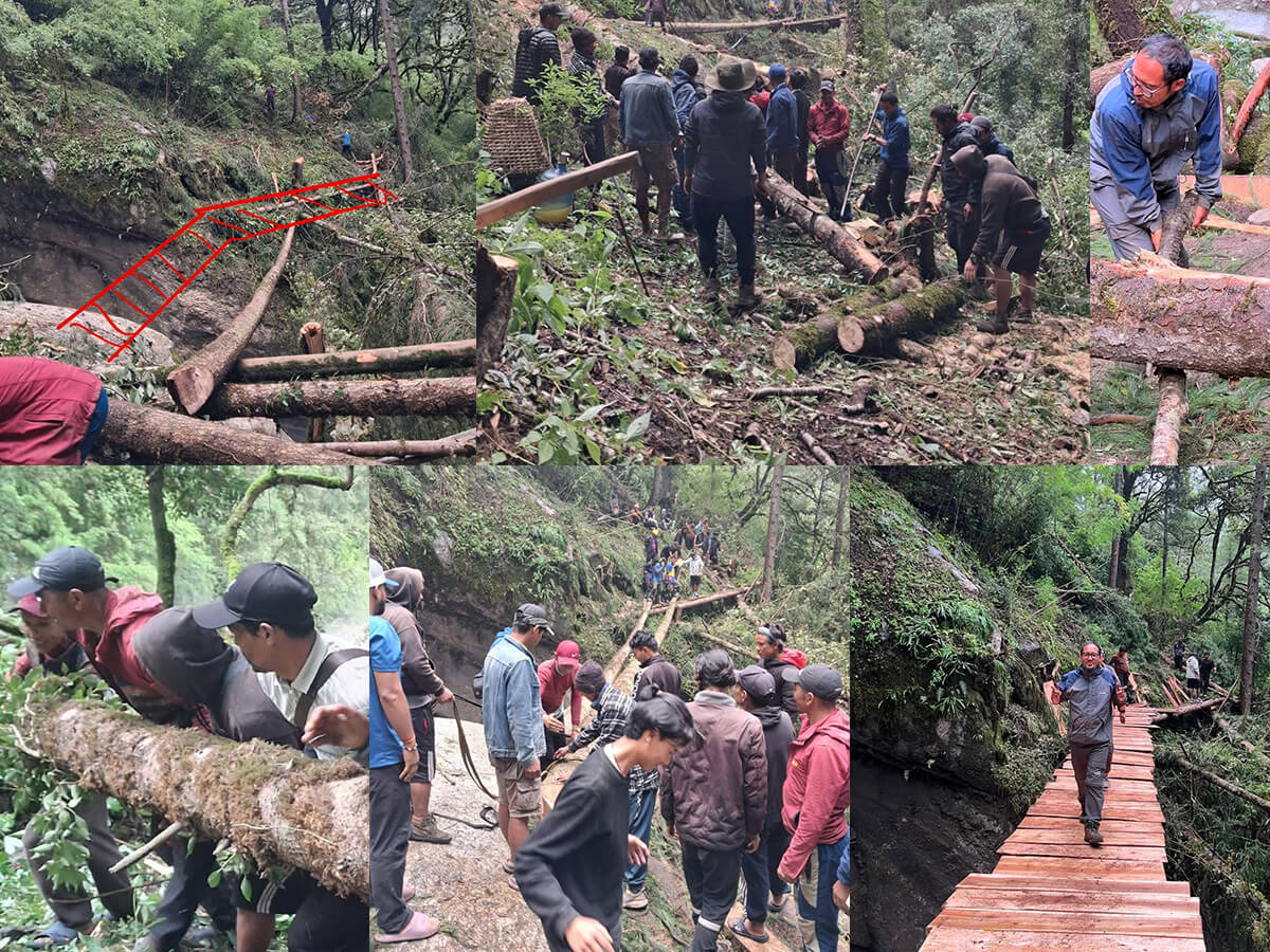
The Alternate Trail Route—What Actually Changes On the Ground
If you've read a Manaslu Circuit itinerary before, most of it is unchanged. The difference occurs in one section:
- Where it applies: The Deng → Namrung stretch, specifically the river crossings around Suksum, Therang, and Syabari.
- What's different: Instead of the original engineered suspension bridge, trekkers now cross via a temporary single-file wooden log structure with rope or timber handrails, plus a rerouted footpath around the damaged section.
- What's unchanged: Everything from Namrung onward—Lho, Samagaun, the acclimatization day, Samdo, Larke Phedi, the Larkya La crossing itself, and the descent to Bimtang and Dharapani—follows the standard route.
In short: this is a localized repair and reroute, not a redesign of the whole trek.
Manaslu Circuit At a Glance (2026 Status)
| Detail |
Current Status |
| Trail status (Sept 2026) |
Open, via temporary crossing near Namrung |
| Affected section |
Deng → Namrung (Suksum / Therang / Syabari) |
| Crossing type |
Temporary wooden log bridge, rope/timber handrail |
| Reported injuries |
None |
| Max altitude |
Larkya La, 5,160 m |
| Typical duration |
14–18 days, Kathmandu to Kathmandu |
| Difficulty |
Strenuous—remote, high-altitude, multi-day exposure |
| Permits required |
Restricted Area Permit (RAP), Manaslu Conservation Area Permit (MCAP), Annapurna Conservation Area Permit (ACAP) |
| Group rule |
Minimum 1 trekkers with a licensed guide |
| Best seasons |
March–May and September–November |
Is It Safe to Cross the Temporary Bridge?
Reasonably, yes, with real caveats. The structure at Suksum was built by experienced local builders using materials and techniques suited to the terrain, and it has already been in active use. But it's a temporary structure, not a permanent engineered bridge, and it should be treated that way:
- Cross one person at a time.
- Keep trekking poles collapsed or held still, not swinging.
- Don't stop mid-crossing for photos.
- Follow your guide's call on timing. River levels and structural load capacity shift with weather, and that's a judgment call best left to someone reading conditions daily, not a fixed rule in an itinerary.
A responsible operator will not lock in a departure date across this section until their on-ground contacts and official advisories both confirm it's stable, and they should be upfront about rerouting or delaying rather than sending a group in on a "wait and see" basis once already on the trail.
Manaslu Circuit Trek 12-Day Itinerary (9-Sept-2026)
|
Day
|
Route
|
Distance
|
Walking Hours
|
Elevation (end point)
|
|
1
|
Kathmandu → Machha Khola
|
150–160 km (drive)
|
7–9 hrs drive
|
869–930 m
|
|
2
|
Machha Khola → Jagat |
22 km |
7–8 hrs
|
1,340 m
|
|
3
|
Jagat → Deng
|
19–20 km |
7–8 hrs
|
1,860–2,095 m
|
|
4
|
Deng → Namrung (New Wooden Bridge: Flood-affected area) |
19–20 km
|
7–8 hrs
|
2,630
|
|
5
|
Namrung → Lho |
11–12 km
|
4–5 hrs
|
3,180 m
|
|
6
|
Lho → Samagaun |
8–9 km
|
3–4 hrs
|
3,520 m
|
|
7
|
Acclimatization (Samagaun)—optional side trip to Pungyen Gompa or MBC |
7–8 km round trip (either option)
|
3–5 hrs
|
Pungyen Gompa 3,870 m / MBC 4,800 m
|
|
8
|
Samagaun → Samdo |
8 km
|
3–4 hrs
|
3,875 m
|
|
9
|
Samdo → Dharamsala (Larke Phedi) |
7.5–8 km
|
3–4 hrs
|
4,460 m
|
|
10
|
Dharamsala → Bimtang (crossing Larkya La) |
14–15 km
|
8–9 hrs
|
Pass: 5,160 m / Bimtang: 3,590 m
|
|
11
|
Bimtang → Tilije |
19–20 km
|
6–7 hrs
|
2,300 m
|
| 12 |
Dharapani/Besisahar → Kathmandu |
180–215 km (drive) |
8–10 hrs drive |
1,350 m (Kathmandu)
|
Trekking Through a Community That's Still Rebuilding
It's deceptively simple to read "trail reopened" as "situation resolved." In reality, the situation is more complex. Namrung, Lho, and Samagaun are Tibetan Buddhist communities with active monasteries and sacred sites, and right now several households in the area are also rebuilding homes and restoring hydropower that the same flood damaged. Trekking groups moving through are guests on a route that the community has just repaired quickly, for their own benefit first.
Practically, this situation means a bit more intentionality than usual:
- Be mindful with cameras and photography near homes and rebuilding work—ask before photographing people, not just landscapes.
- Follow standard etiquette at gompas and mani walls (pass to the left, keep voices down, and ask before entering).
- Support local teahouses and lodges directly rather than treating the stop as incidental—spending here goes further than usual this season.
Do You Need a Guide for the Manaslu Circuit?
Yes. This isn't optional or a recommendation; it's a permit requirement. Manaslu is a restricted area, which means a minimum of two trekkers accompanied by a licensed guide, in addition to holding the RAP, MCAP, and ACAP permits. Solo trekking, in the sense that's common on Annapurna or Everex Base Camp routes, isn't permitted here.
Best Time to Trek Manaslu Circuit in 2026
Spring (March–May) and autumn (September–November) remain the two stable weather windows. If you're booking an early-autumn 2026 departure specifically, factor in post-monsoon trail conditions near Namrung. This is exactly the window where river levels and the temporary crossing's condition matter most and where a flexible itinerary with buffer days pays off.
FAQ
Is it safe to cross the temporary bridge near Namrung?
The temporary structure is a wooden log crossing with rope or timber handrails, built by local indigenous builders. It's functional and in active use, but it isn't a permanent engineered bridge. Cross one person at a time, follow your guide's instructions, and avoid stopping on the crossing for photos.
How long does the Manaslu Circuit Trek take?
Most Manaslu Circuit Trek itineraries take 12 to 18 days, from Kathmandu to Kathmandu, including acclimatization time in Samagaun and buffer days for weather or river conditions.
Is the Manaslu Circuit Trek open in September of 2026?
Yes. After a flash flood destroyed the original Budhi Gandaki bridge on 6 September 2026, local communities in Chumnubri Rural Municipality rebuilt a temporary wooden crossing and alternate footpath near Namrung. The trail to Samagaun and Larke Pass is now open again. Trekkers should check with their operator before they book, as conditions change with the weather.
What caused the Manaslu Circuit trail closure in 2026?
The flash flood on Therang Khola, a tributary of the Budhi Gandaki River, struck on September 6, 2026, near Namrung in Chumnubri Rural Municipality-4, Gorkha district. It destroyed the main suspension bridge and another nearby crossing, several homes, and two micro-hydropower plants. There were no injuries.
Do I need a guide for the Manaslu Circuit Trek?
Yes. Manaslu is a restricted area designated by the government that legally requires a minimum of two trekkers with a licensed guide and a Restricted Area Permit (RAP), Manaslu Conservation Area Permit (MCAP), and Annapurna Conservation Area Permit (ACAP).
Best season for trekking the Manaslu Circuit?
The best weather for the Manaslu Circuit is in spring (March–May) and autumn (September–November). Those departing in early autumn 2026 should pay particular attention to trail conditions around Namrung post-monsoon.
What is the highest point of the Manaslu Circuit?
The highest point of the trek is Larkya La (Larke Pass) at 5106 meters.
Likewise, the main lifeline Kathmandu to Pokhara Highway also reopened to two-way traffic on 17th September 2026, which had been blocked since August 30 due to the second Rasuwa Bhote Koshi flood. After concluding the Manaslu Circuit trek, drive from Tilje-Dharapani-Besi Sahar Dumre-Abukhairenai-Mugling Krishna Bhir (reopened road) to Kathmandu. The Prithvi Highway road blocked at Krishna Bhir was 85 km from Kathmandu. Now, the road provides access to Pokhara, Chitwan, and other cities from the capital.
Can Walk the Manaslu-Manin Trail?
Yes! Now, the Budhigandaki River's water level has decreased, and Mr. Laxman Gurung, the chairperson of the local government of Dharche Rural Municipality in Gorkha District, along with local people and tourism stakeholders, has been working aggressively to improve the trail. Consequently, the Manaslu Circuit Trek main trail has been built from Khorlabesi to Tataopani and Jagat. The trekkers are already heading to Larkya pass through this trail.
Conclusion:
The Manaslu Circuit Trek has been progressing to open again after a flash flood on October 11th, 2026, through the Ungilung Khola (stream) between Lokpa and Chumling and Chumchet. Good news for trekkers and mountain lovers who are looking for the Manalsu trek. Local people, the local government, and local tourism stakeholders have repaired the damaged sections of the trail from Khorlabesi to Tatopani and Jagat, so you can now walk freely along the main trail. Many trekking groups are walking through this main trail from the 21st of October 2026. Local people and some trekkers have crossed this trail on their way to the Manaslu-Larke-La pass trek since 18th October 2026. Furthermore, the Bailey bridge at Aurughat Bazaar was installed today (18-Oct-2026), allowing people from Dhading and Gorkha to rejoin and drive all the way to Machhakhola and Khorlabesi.